
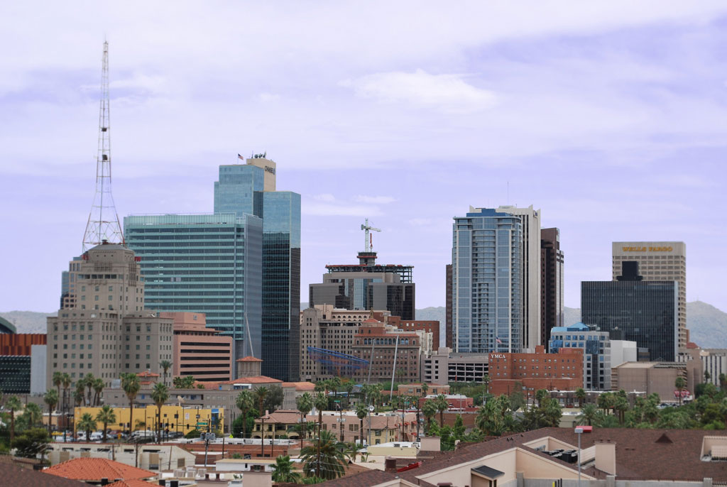
- World Radio Map • North America • United States • Arizona • Phoenix
Radio stations in Phoenix, AZEmisoras de radio en Phoenix, AZClick on the radio station name to listen online / Haga clic en el emisora para escuchar en vivo |
||
| FM,MHz | Station | Transmitter |
| 88.3 |
 KVCP VCY America KVCP VCY America
└ HD2 VCY Sacred Stylings
└ HD3 VCY Spanish
└ HD4  Family Radio Family Radio
|
North Mountain Shaw Butte |
| 88.7 |
 KVIT The Pulse KVIT The Pulse
|
Maricopa |
| 88.9 |
K205CI Family Radio
|
North Mountain Shaw Butte |
| 89.1 |
 KLVK K-Love KLVK K-Love
└ HD2  Air 1 Air 1
|
White Tanks |
| 89.5 |
 KBAQ K-Bach KBAQ K-Bach
└ HD2  Radio Bilingüe Radio Bilingüe
└ HD3  Sun Sounds of Arizona Sun Sounds of Arizona
|
South Mountain |
| 89.7 |
K209DV K-Bach
|
Scottsdale, McDowell Mountains, Thompson Peak |
| 89.9 |
KLVA K-Love
|
Mazatzal Mountains |
| 90.3 |
 KFLR Family Life Radio KFLR Family Life Radio
|
South Mountain |
| 90.7 |
 K214DN Radio Nueva Vida K214DN Radio Nueva Vida
|
North Mountain Shaw Butte |
| 90.7 |
 KRDP Jazz KRDP Jazz
|
Apache Junction, East Valley Institute of Technology |
| 90.9 |
KLVH K-Love
|
Cottonwood, Mingus Mountain |
| 91.1 |
 K216FO Manantial FM K216FO Manantial FM
|
South Mountain |
| 91.5 |
 KJZZ Public Radio KJZZ Public Radio
└ HD2  Jazz PHX Jazz PHX
└ SCA Sun Sounds of Arizona
|
South Mountain |
| 91.7 |
K219DZ Public Radio
|
Scottsdale, McDowell Mountains, Thompson Peak |
| 91.9 |
 K220FM K-Rocky K220FM K-Rocky
|
North Mountain Shaw Butte |
| 92.3 |
 KTAR News KTAR News
└ HD2  Mormon Channel Mormon Channel
|
South Mountain |
| 92.7 |
 K224CJ Oldies 92.7 K224CJ Oldies 92.7
|
South Mountain |
| 92.9 |
 K225CT La Hermosa Radio K225CT La Hermosa Radio
|
North Mountain Shaw Butte |
| 93.3 |
 KDKB ALT AZ KDKB ALT AZ
└ HD2 Oldies 92.7
|
South Mountain |
| 93.7 |
 K229DB El Patrón K229DB El Patrón
|
South Mountain |
| 93.9 |
 KWSS Independent Radio KWSS Independent Radio
|
North Mountain Shaw Butte |
| 94.1 |
 KRDE The Ride KRDE The Ride
|
Globe, Pinal Range |
| 94.5 |
 KOOL Big 94.5 KOOL Big 94.5
└ HD2 Independent Radio
└ HD3  La Z La Z
|
South Mountain |
| 94.9 |
 K235CB The Zone K235CB The Zone
|
South Mountain |
| 95.1 |
 KOAI The Wow Factor KOAI The Wow Factor
|
Bradshaw Mountains, Towers Mountain |
| 95.5 |
 KYOT The Mountain KYOT The Mountain
└ HD2  KFYI News Talk KFYI News Talk
└ HD3  Your Celebration Your Celebration
|
South Mountain |
| 95.9 |
K240DC K-Love
|
White Tanks |
| 95.9 |
 K240EU The Fanatic K240EU The Fanatic
|
Fountain Hills |
| 96.1 |
 K241BQ Radio Xtasis K241BQ Radio Xtasis
|
South Mountain |
| 96.1 |
K241CS Radio Xtasis
|
North Mountain Shaw Butte |
| 96.3 |
 KSWG Real Country KSWG Real Country
|
Wickenburg, S Vulture Mine Rd |
| 96.5 |
K243BN La Z
|
South Mountain |
| 96.5 |
KZOM La Z
|
Globe, Signal Peak |
| 96.9 |
 KMXP Mix 96.9 KMXP Mix 96.9
└ HD2  Pride Radio Pride Radio
|
South Mountain |
| 97.3 |
 K247CF The Buzz K247CF The Buzz
|
South Mountain |
| 97.5 |
 KMVA Hot 97.5/103.9 KMVA Hot 97.5/103.9
|
Bradshaw Mountains, Towers Mountain |
| 97.9 |
 KUPD Real Rock KUPD Real Rock
|
South Mountain |
| 98.3 |
 KKFR Power 98.3 KKFR Power 98.3
|
Bradshaw Mountains, Towers Mountain |
| 98.7 |
 KMVP Arizona Sports KMVP Arizona Sports
|
South Mountain |
| 99.1 |
 KFXY Alternative Radio KFXY Alternative Radio
|
Mesa, Usery Mountain |
| 99.3 |
 K257CD Mega 99.3 K257CD Mega 99.3
|
North Mountain |
| 99.5 |
 KRPH La Onda KRPH La Onda
|
Wickenburg, Yarnell + Morristown, Hieroglyphic Mountain |
| 99.9 |
 KESZ 99.9-KEZ KESZ 99.9-KEZ
└ HD2  Magic Magic
└ HD3  Fox Sports 910 Fox Sports 910
|
South Mountain |
| 100.3 |
 KQMR Latino Mix KQMR Latino Mix
|
Globe, Pinal Range |
| 100.7 |
 KSLX Classic Rock KSLX Classic Rock
└ HD2  KDUS Sports Radio KDUS Sports Radio
|
South Mountain |
| 101.1 |
 KZCE The Bounce KZCE The Bounce
|
Bradshaw Mountains, Wildflower Mountain |
| 101.5 |
 KALV Live 101.5 KALV Live 101.5
└ HD2  Channel Q Channel Q
└ HD3  Z89.3 Z89.3
|
South Mountain |
| 101.9 |
 K270BZ La Campesina K270BZ La Campesina
|
South Mountain |
| 102.1 |
 KAHM Calm Radio KAHM Calm Radio
|
Cottonwood, Mingus Mountain |
| 102.5 |
 KNIX Country KNIX Country
└ HD2  TikTok Radio TikTok Radio
|
South Mountain |
| 102.9 |
 KDIF KDIF
|
6401 S 16th St |
| 102.9 |
 K275CP Relevant Radio K275CP Relevant Radio
|
North Mountain Shaw Butte |
| 103.1 |
 KSCW Sun City West Radio KSCW Sun City West Radio
|
Sun City West |
| 103.1 |
 KCDX Rock&Roll KCDX Rock&Roll
|
Florence, Black Mountain |
| 103.5 |
 KLNZ La Tricolor KLNZ La Tricolor
|
White Tanks |
| 103.9 |
KZON Hot 97.5/103.9
└ HD2 The Zone
└ HD3 Radio Xtasis
|
Queen Creek, E Ocotillo Rd |
| 104.3 |
 KAJM Sunny 104.3 KAJM Sunny 104.3
|
Bradshaw Mountains, Wildflower Mountain |
| 104.7 |
 KZZP Kiss FM KZZP Kiss FM
|
South Mountain |
| 105.1 |
 KHOV Qué Buena KHOV Qué Buena
|
Wickenburg, Yarnell + Morristown, Hieroglyphic Mountain |
| 105.3 |
 K287BX Money Radio K287BX Money Radio
 Bloomberg Radio Bloomberg Radio
|
North Mountain |
| 105.5 |
KAIZ Air 1
└ HD2  Boost Radio Boost Radio
|
Avondale, Hayes Peak |
| 105.9 |
KHOT Qué Buena
|
Downtown Phoenix, Chase Tower + Fountain Hills, Eagle Mountain |
| 106.3 |
 KOMR Amor 106.3 KOMR Amor 106.3
|
Morristown, Hieroglyphic Mountain |
| 106.5 |
 K293CO La Mejor K293CO La Mejor
|
6099 S 38th St |
| 106.7 |
 KFUE Radio Fuego KFUE Radio Fuego
|
Buckeye Military Reservation |
| 107.1 |
 KVVA La Suavecita KVVA La Suavecita
└ HD2 Radio Fuego
|
South Mountain |
| 107.5 |
K298CK Family Radio
|
North Mountain Shaw Butte |
| 107.9 |
 KMLE Country KMLE Country
└ HD2  The Bet The Bet
└ HD3 Mega 99.3
|
South Mountain |
| WX,MHz | Station | Transmitter |
| 162.425 |
 WWG41 NOAA Weather Radio WWG41 NOAA Weather Radio
|
Mount Ord |
| 162.500 |
WWG42 NOAA Weather Radio
|
Globe, Signal Peak |
| 162.550 |
KEC94 NOAA Weather Radio
|
South Mountain |
| AM,kHz | Station | Transmitter |
| 530 |
 WPQI768 Hwy Advisory Radio WPQI768 Hwy Advisory Radio
|
I-10, I-17 |
| 550 |
KFYI News Talk
|
6505 S 36th St |
| 580 |
 KSAZ La Indiscreta KSAZ La Indiscreta
|
Tucson, AZ, W Trico Marana Rd |
| 600 |
 KVNA ESPN Flagstaff KVNA ESPN Flagstaff
|
Flagstaff, AZ, E Huntington Dr |
| 620 |
KTAR ESPN Phoenix
|
Tower Plaza at 36th St and E Thomas Rd |
| 640 |
 KFI Talk Radio KFI Talk Radio
|
Los Angeles, CA, Buena Park |
| 660 |
 KTNN The Voice of Navajo Nation KTNN The Voice of Navajo Nation
|
Window Rock, Sawmill |
| 740 |
 KIDR En Familia Radio KIDR En Familia Radio
|
9000 S 23rd Ave |
| 770 |
 KKOB NewsRadio KKOB NewsRadio
|
Albuquerque, NM, 300 Cam Los Luceros |
| 780 |
 KAZM Mellow Mountain Radio KAZM Mellow Mountain Radio
|
Sedona |
| 800 |
 XEROK Calibre 800 XEROK Calibre 800
|
Mexico, Cd. Juárez, Chih., Plaza Sendero |
| 830 |
 KDRI The Drive KDRI The Drive
|
Tucson, AZ, W Sunshine Ln |
| 860 |
KNAI La Campesina
|
W Lower Buckeye Rd |
| 910 |
KGME Fox Sports 910
|
2900 W Maryland Ave |
| 960 |
 KKNT The Patriot KKNT The Patriot
|
Desert Ridge |
| 990 |
 KTKT La Buena 94.3 KTKT La Buena 94.3
|
Tucson, AZ, Juhan Park |
| 1010 |
 KXXT Family Values Radio KXXT Family Values Radio
|
S 67th Ave |
| 1060 |
KDUS Sports Radio
 SportsMap Radio SportsMap Radio
|
Tempe, 1900 W Carmen St |
| 1100 |
 KFNX News Talk KFNX News Talk
|
Cave Creek, 4157 E Carefree Hwy |
| 1190 |
KNUV La Onda
|
Tolleson |
| 1230 |
KOY El Patrón
|
2345 W Buckeye Rd |
| 1260 |
KBSZ The Buzz
|
Apache Junction |
| 1280 |
KXEG Radio Xtasis
|
Payne Industrial District |
| 1310 |
KIHP Relevant Radio
|
Mesa Cemetery |
| 1330 |
 KASC Blaze Radio KASC Blaze Radio
|
Tempe, Arizona State University (Carrier current) |
| 1360 |
 KPXQ Christian Radio KPXQ Christian Radio
|
Glendale, Grand Canal Linear Park |
| 1400 |
KSUN La Mejor
|
6099 S 38th St |
| 1440 |
KAZG Oldies 92.7
|
Scottsdale, 64th St and Thomas Rd |
| 1480 |
KPHX La Hermosa Radio
|
Lindo Park |
| 1510 |
KFNN Money Radio
Bloomberg Radio
|
Desert Ridge |
| 1550 |
 KUAZ AZPM Public Radio KUAZ AZPM Public Radio
|
Tucson, AZ, 9100 I-10 Frontage Rd |
| 1580 |
KQFN The Fanatic
|
Payne Industrial District |
| 1610 |
 WXK790 PHX Airport Radio WXK790 PHX Airport Radio
|
Phoenix Sky Harbor International Airport |
Westward Ho
Coordinates: 33°27'18" N, 112°04'28" W
The Westward Ho (also known as Roosevelt Hotel) is a high-rise building in Phoenix, Arizona. The 16-story building, which is 208 ft (63m) to the roof and 488 ft (149 m) to the antenna top, held the title of tallest building in Arizona for over 30 years until the completion of the Phoenix Corporate Center in 1960. The 240 ft (73 m) steel tower and 40 ft (12 m) antenna on top of the building were erected in 1949 to broadcast Phoenix's first television station, KPHO-TV. In 1960, KPHO moved to its new transmitter on South Mountain, the antenna on Westward Ho now functions as a cell tower.
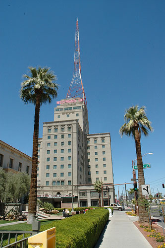

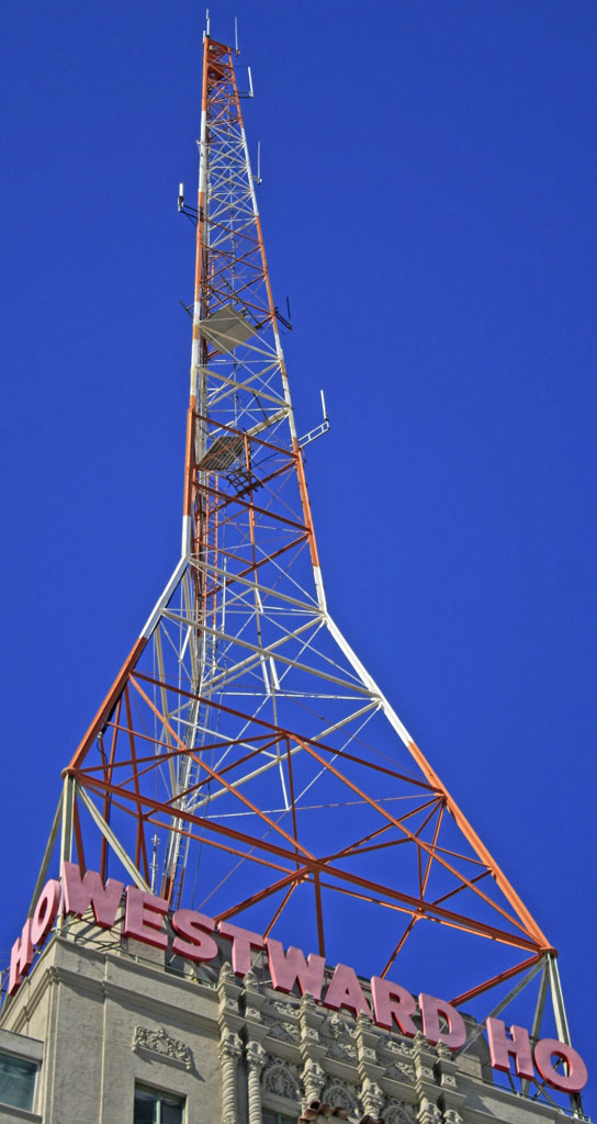
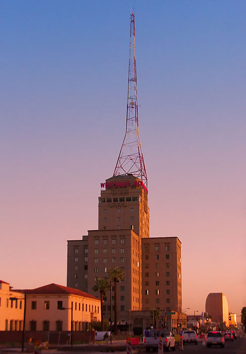

More info: Wikipedia
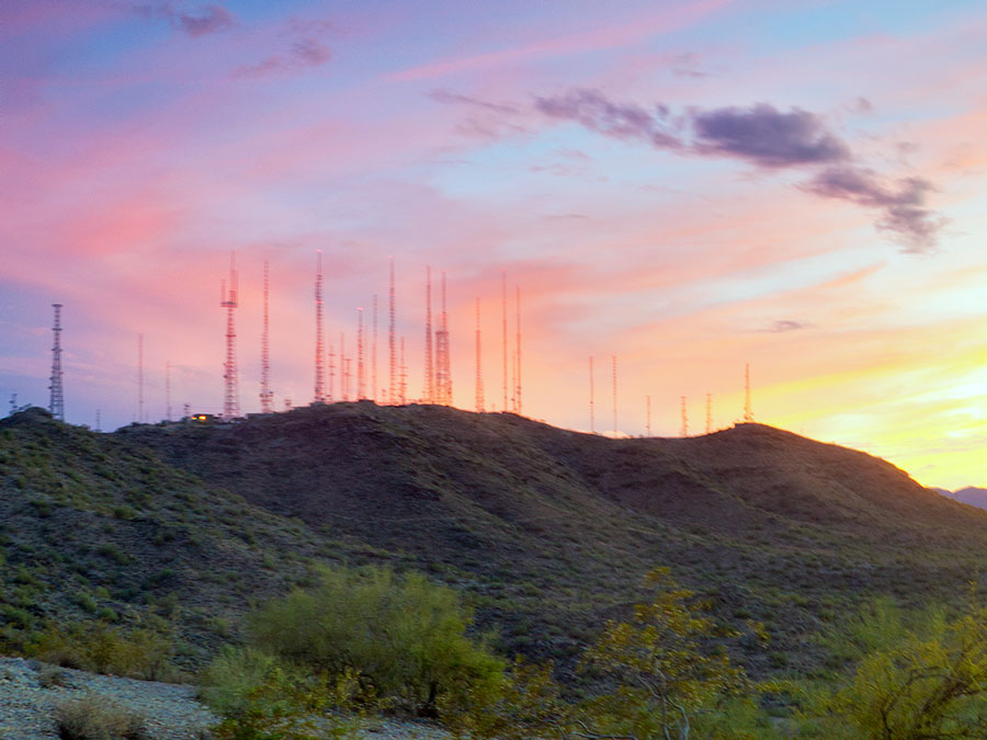
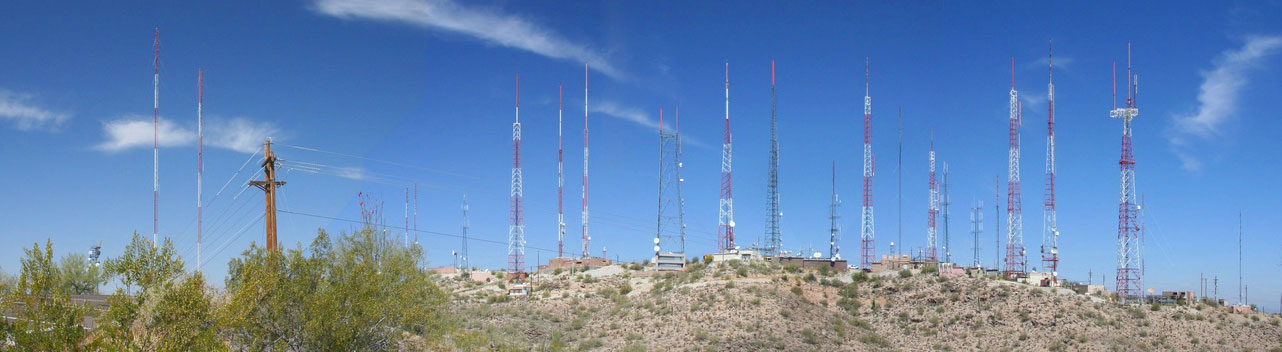
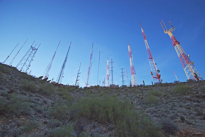
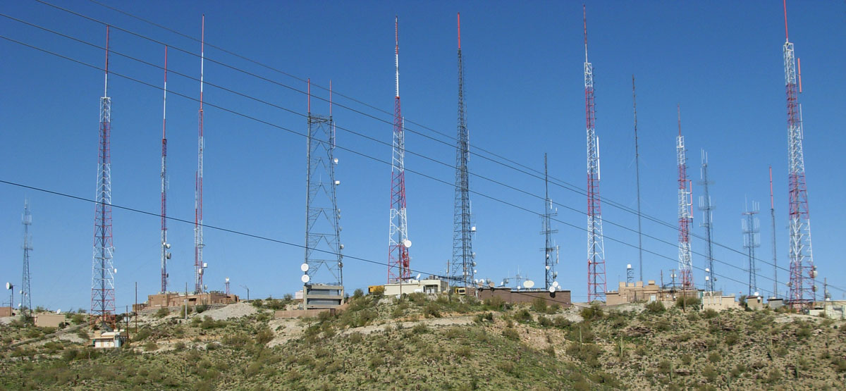
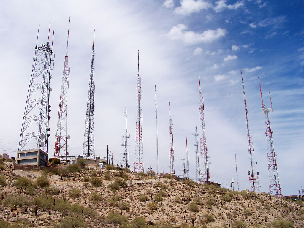
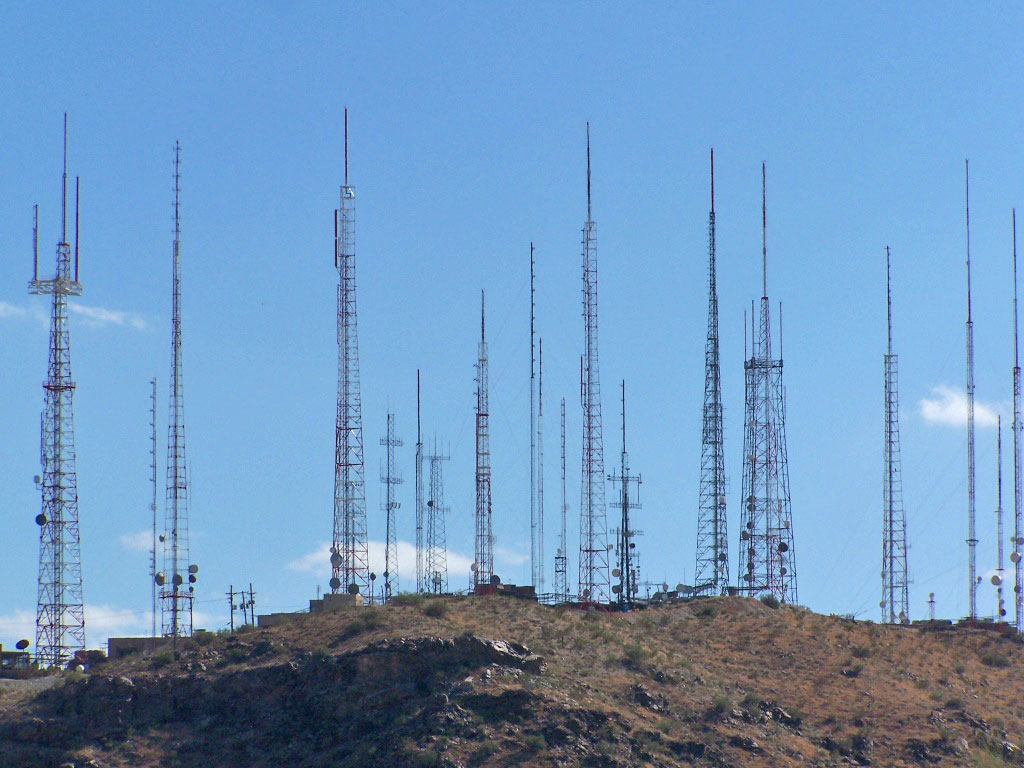
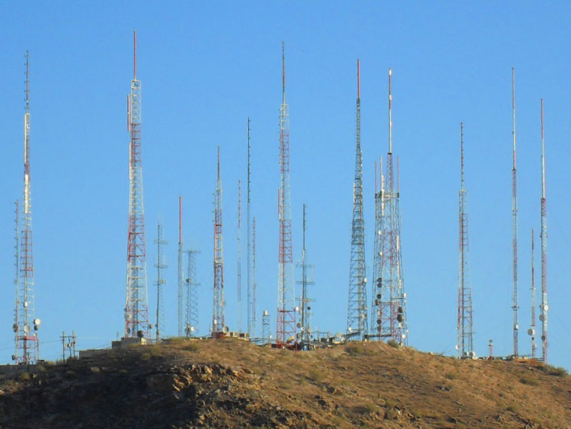
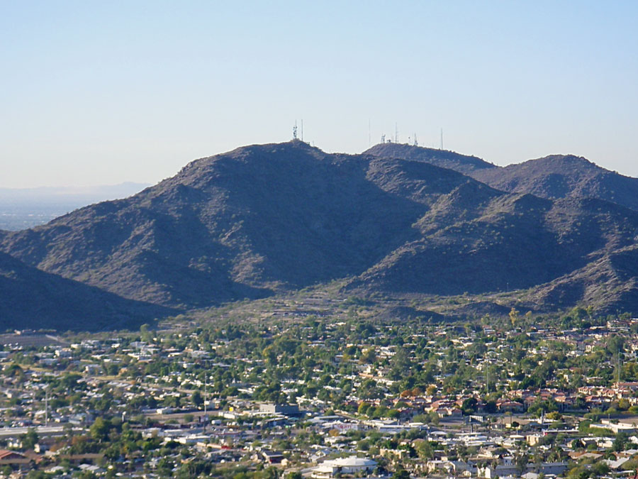
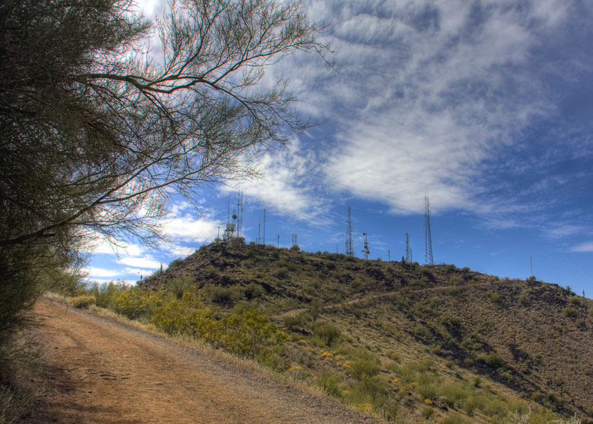
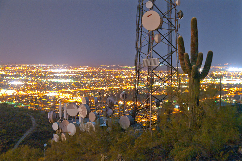
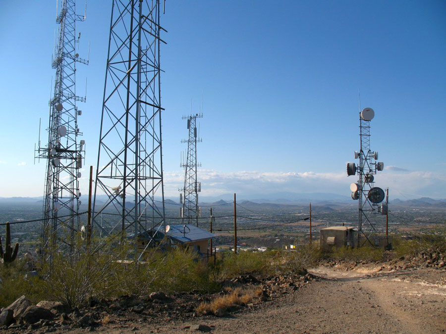
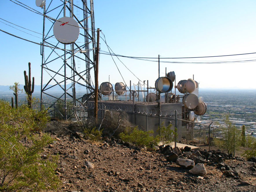
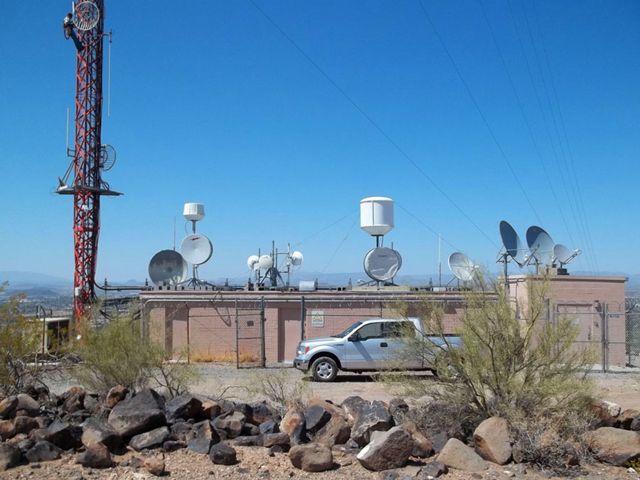
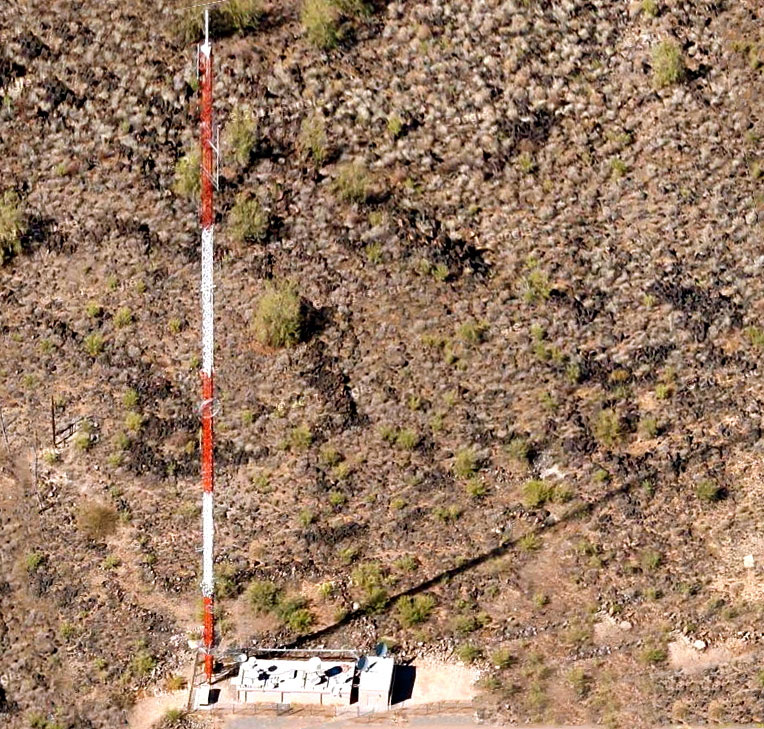
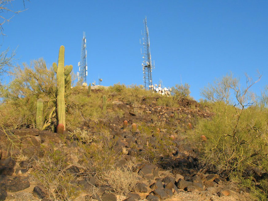
South Mountain (Mount Suppoa)
Coordinates: 33°19'58" N, 112°03'47" W
The South Mountain is a mountain range in central Arizona in south Phoenix, Arizona. It is on public land managed by the city of Phoenix as South Mountain Park. Mount Suppoa (TV Tower Peak), highest point in the mountains at 2690 ft (820 m). Contains numerous radio and television transmitters serving the Phoenix area, especially those of the major network-affiliated stations.
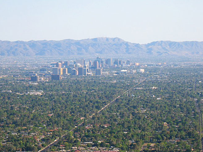
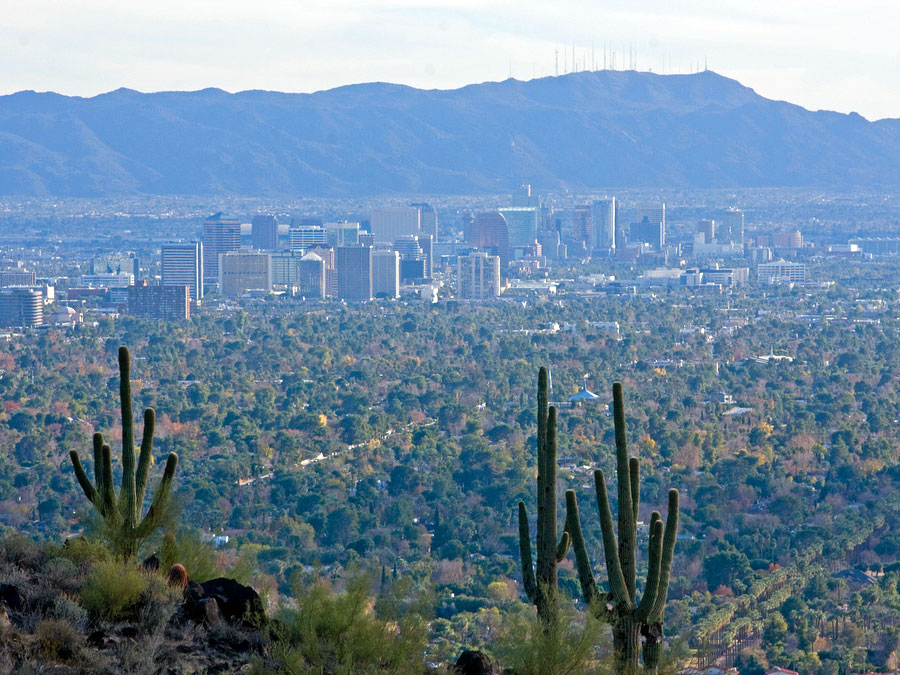


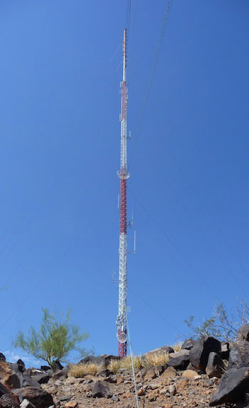
North Mountain (Shaw Butte)
Coordinates: 33°35'39" N, 112°05'15" W


Useful links
ABA - Arizona Broadcasters Association
House of Broadcasting - Arizona's Radio & Television Museum
Central Arizona DX Association
Friends of Public Radio Arizona
Phoenix Airchecks
Fybush.com Tower site of the week: South Mountain, Phoenix, Arizona (2001)
Fybush.com Tower site of the week: KTAR 620, Phoenix, Arizona (2009)
Fybush.com Tower site of the week: Phoenix, 2009 (part II) (2009)
Fybush.com Tower site of the week: Phoenix, 2009 (part III) (2009)
Tophour.com audio: Phoenix Legal IDs
RadioDiscussions.com - Phoenix Message Board
RadioDiscussions.com - Arizona Message Board
Phoenix, Arizona at Radio-Locator.com
