
- World Radio Map • North America • United States • California • Los Angeles
Radio stations in Los Angeles, CAEmisoras de radio en Los Ángeles, CAClick on the radio station name to listen online / Haga clic en el emisora para escuchar en vivo |
||
| FM,MHz | Station | Transmitter |
| 87.75 |
 KZNO Guadalupe Radio KZNO Guadalupe Radio
|
Angeles National Forest, Mt. Harvard |
| 88.1 |
 KKJZ KJazz KKJZ KJazz
└ HD2  The Bebop Channel The Bebop Channel
└ HD3  22 West Radio 22 West Radio
|
Long Beach, Signal Hill |
| 88.5 |
 KCSN The SoCal Sound KCSN The SoCal Sound
└ HD2  Bilingual Sounds Bilingual Sounds
└ SCA  LA Radio Reading Service LA Radio Reading Service
|
Beverly Hills |
| 88.7 |
 KSPC The Space KSPC The Space
|
Claremont, Pomona College |
| 88.9 |
 KXLU KXLU
|
Westchester, Loyola Marymount University |
| 89.3 |
 KPCC LAist KPCC LAist
└ HD2  MPR The Current MPR The Current
|
Angeles National Forest, Mt. Wilson |
| 89.9 |
 KCRW Public Radio KCRW Public Radio
└ HD2  Eclectic 24 Eclectic 24
|
Mulholland Drive, Laurel Hills |
| 90.3 |
 K212FA eight. K212FA eight.
|
Mount Wilson |
| 90.3 |
 KMRO Radio Nueva Vida KMRO Radio Nueva Vida
|
Ventura, Sulphur Mountain |
| 90.3 |
 KLIE Radio Suerte KLIE Radio Suerte
|
Costa Mesa |
| 90.7 |
 KPFK Pacifica Radio KPFK Pacifica Radio
|
Angeles National Forest, Mt. Wilson |
| 91.1 |
 K216EM Air 1 K216EM Air 1
|
Glendale, San Rafael Hills, Flint Peak |
| 91.5 |
 KUSC Classical California KUSC Classical California
|
Angeles National Forest, Mt. Harvard |
| 91.9 |
K220HC Air 1
|
Hollywood, Briar Summit |
| 92.3 |
 KRRL Real 92.3 KRRL Real 92.3
└ HD2  Black Information Netw. Black Information Netw.
|
Angeles National Forest, Mt. Wilson |
| 92.7 |
KYLA Radio Nueva Vida
└ HD2  K-Love K-Love
└ HD3  K-Love Eras K-Love Eras
|
Irvine, Signal Peak |
| 93.1 |
 KCBS Jack FM KCBS Jack FM
└ HD2  K-Frog K-Frog
└ HD3  The Bet The Bet
|
Angeles National Forest, Mt. Wilson |
| 93.5 |
 KDAY KDAY
|
Baldwin Hills, Hahn Park |
| 93.9 |
 KLLI Cali 93.9 KLLI Cali 93.9
└ HD2  RAIN FM RAIN FM
|
Angeles National Forest, Mt. Wilson |
| 94.3 |
 KEBN Qué Buena KEBN Qué Buena
|
Orange, 1 City Blvd W, City Plaza |
| 94.3 |
KBUA Qué Buena
|
San Fernando, Granada Hills |
| 94.7 |
 KTWV The Wave KTWV The Wave
└ HD2  Nor Radio Nor Radio
└ HD3  Radio Hamrah Radio Hamrah
|
Angeles National Forest, Mt. Wilson |
| 95.1 |
KFRG K-Frog
|
San Bernardino, CA, Cloudland Truck Trail |
| 95.5 |
 KLOS Rock Station KLOS Rock Station
└ HD2  Talk Station Talk Station
└ HD3  KIRN رادیو ایران KIRN رادیو ایران
|
Angeles National Forest, Mt. Wilson |
| 95.9 |
KAIA Air 1
|
Anaheim Hills |
| 96.3 |
 KXOL La Mega KXOL La Mega
|
Glendale, Verdugo Mountains, Tongva Peak |
| 96.7 |
 KWIZ Radio Visión Latina KWIZ Radio Visión Latina
|
Anaheim Hills |
| 97.1 |
 KNX The Fan KNX The Fan
└ HD2  KNX News KNX News
└ HD3  Fire Lane Fire Lane
|
Angeles National Forest, Mt. Wilson |
| 97.5 |
 KLYY José 97.5/107.1 KLYY José 97.5/107.1
|
San Bernardino, CA, Heaps Peak |
| 97.9 |
 KLAX La Raza KLAX La Raza
└ HD2  La Privada La Privada
|
Glendale, San Rafael Hills, Flint Peak |
| 98.3 |
 KRCV Recuerdo 103.9-98.3 KRCV Recuerdo 103.9-98.3
|
San Dimas, San Jose Hills |
| 98.7 |
 KYSR Alt 98.7 KYSR Alt 98.7
└ HD2  TikTok Radio TikTok Radio
|
Mulholland Drive, Laurel Hills |
| 99.1 |
 K256CX KWave K256CX KWave
|
Irwindale |
| 99.1 |
 KTPC Venice FM KTPC Venice FM
|
Venice (5 AM-9 PM) |
| 99.1 |
 KLDB dublab KLDB dublab
|
Hollywood, Briar Summit (9 PM-1 AM) |
| 99.1 |
 KFEP KFEP
|
Hollywood, Briar Summit (1 AM-3 AM) |
| 99.1 |
 KZUT LAVA Radio KZUT LAVA Radio
|
Hollywood, Briar Summit (3 AM-5 AM) |
| 99.1 |
 KLBP Long Beach Public Radio KLBP Long Beach Public Radio
|
Long Beach |
| 99.1 |
 KWSV The Ranch KWSV The Ranch
|
Simi Valley, Hummingbird Nest Ranch + Chatsworth Peak |
| 99.1 |
 KBUU Radio Malibu KBUU Radio Malibu
└ HD2  The Mighty 690 The Mighty 690
└ HD3  J1 HD J1 HD
|
Malibu |
| 99.5 |
 KKLA KKLA
|
Angeles National Forest, Mt. Wilson |
| 99.9 |
 KOLA KOLA
|
Riverside, CA, Box Springs Mountain |
| 100.3 |
 KKLQ Positive, Encouraging KKLQ Positive, Encouraging
└ HD2 Air 1
└ HD3 Radio Nueva Vida
|
Angeles National Forest, Mt. Wilson |
| 100.7 |
 K264CQ La Primera K264CQ La Primera
 TUDN Radio TUDN Radio
|
Crenshaw |
| 101.1 |
 KRTH K-Earth 101 KRTH K-Earth 101
└ HD2  Channel Q Channel Q
|
Angeles National Forest, Mt. Wilson |
| 101.5 |
 KZKA ESNE Radio Católica KZKA ESNE Radio Católica
|
City West, Los Angeles Center Studios |
| 101.5 |
K268DD ESNE Radio Católica
|
Baldwin Hills, Hahn Park |
| 101.5 |
 KHBG KHBG
|
Pasadena |
| 101.5 |
 KQSG KQSG
|
Monterey Park |
| 101.9 |
 KSCA La Nueva KSCA La Nueva
└ SCA  金華之聲 金華之聲
|
Angeles National Forest, Mt. Wilson |
| 102.3 |
 KJLH Radio Free KJLH Radio Free
|
Baldwin Hills, Hahn Park |
| 102.7 |
 KIIS FM KIIS FM
|
Angeles National Forest, Mt. Wilson |
| 103.1 |
 KDLD Reyna 103.1 KDLD Reyna 103.1
|
Baldwin Hills, Hahn Park |
| 103.5 |
 KOST KOST
└ HD2  KFI Talk Radio KFI Talk Radio
|
Angeles National Forest, Mt. Wilson |
| 103.9 |
KRCD Recuerdo 103.9-98.3
└ HD2 ESNE Radio Católica
└ HD3  KTNQ Noticias KTNQ Noticias
|
Baldwin Hills, Hahn Park |
| 104.3 |
 KBIG My FM KBIG My FM
└ HD2  LA Sports LA Sports
|
Angeles National Forest, Mt. Wilson |
| 104.7 |
 KOCP Old School 104.7 KOCP Old School 104.7
|
Ventura, Orcutt Ridge + Malibu, Castro Peak + San Fernando + Santa Monica |
| 105.1 |
 KKGO Go Country 105 KKGO Go Country 105
└ HD2  K-Mozart K-Mozart
└ HD3  Go Country Go Country
└ HD4  K-Surf Smooth Jazz K-Surf Smooth Jazz
|
Angeles National Forest, Mt. Wilson |
| 105.5 |
KBUE La Qué Buena
|
Long Beach - Compton |
| 105.9 |
 KPWR Power 106 KPWR Power 106
|
Angeles National Forest, Mt. Wilson |
| 106.3 |
K292HC RAIN FM
|
Koreatown, Wilshire/Western |
| 106.3 |
 KALI Saigon Radio Hải Ngoại KALI Saigon Radio Hải Ngoại
└ HD2  RadioK1230 우리방송 RadioK1230 우리방송
└ HD3  中文廣播電臺 中文廣播電臺
|
Santa Ana |
| 106.7 |
 KROQ KROQ
└ HD2  Roq of the 80s Roq of the 80s
|
Glendale, Verdugo Mountains, Tongva Peak |
| 107.1 |
KSSE José 97.5/107.1
|
Angeles National Forest, Santa Anita Canyon Rd |
| 107.5 |
 KLVE Radio K-Love KLVE Radio K-Love
└ HD2  Radio Jan Radio Jan
└ HD3  Arm Music Radio Arm Music Radio
└ HD4  Pop FM Pop FM
|
Angeles National Forest, Mt. Wilson |
| 107.7 |
 KCTY The City KCTY The City
|
Long Beach, Long Beach City College |
| 107.9 |
KWVE KWave
└ HD2  dot.bible (Español) dot.bible (Español)
└ HD2 dot.bible (中文)
└ HD4 dot.bible (Tiếng Việt)
|
Santa Ana Mountains, Santiago Peak |
| WX,MHz | Station | Transmitter |
| 162.400 |
 WZ2505 NOAA Weather Radio WZ2505 NOAA Weather Radio
|
Sandberg |
| 162.450 |
WWG21 NOAA Weather Radio
|
Santa Ana Mountains, Beeks Place |
| 162.525 |
WNG584 NOAA Weather Radio
|
Avalon |
| 162.550 |
KWO37 NOAA Weather Radio
|
Mount Lukens |
| AM,kHz | Station | Transmitter |
| 530 |
 WNHV296 LAX Airport Radio WNHV296 LAX Airport Radio
|
Los Angeles Intenational Airport |
| 540 |
 XESURF Radio Zión XESURF Radio Zión
|
Mexico, Tijuana, BC, Dorada |
| 570 |
KLAC LA Sports
 Fox Sports Radio Fox Sports Radio
|
El Sereno |
| 590 |
 KTIE The Answer KTIE The Answer
|
San Bernardino, CA, Colton |
| 600 |
 KOGO NewsRadio KOGO NewsRadio
|
San Diego, CA, Emerald Hills |
| 640 |
KFI Talk Radio
|
Buena Park |
| 670 |
KIRN رادیو ایران
|
Simi Valley |
| 690 |
 XEWW La Gigante XEWW La Gigante
|
Mexico, Tijuana, BC, Rosarito |
| 710 |
 KSPN ESPN Los Angeles KSPN ESPN Los Angeles
|
Irwindale |
| 740 |
 KBRT KBrite Radio KBRT KBrite Radio
|
Santa Ana Mountains, Oak Flat |
| 760 |
 KGB San Diego Sports KGB San Diego Sports
|
San Diego, CA, Mission Gorge |
| 790 |
 KABC Talk Radio KABC Talk Radio
|
Crenshaw |
| 830 |
 KLAA Angels Radio
ESPN Radio KLAA Angels Radio
ESPN Radio
|
Chino |
| 870 |
 KRLA The Answer KRLA The Answer
|
Glendale, 4970 Wawona St |
| 900 |
 KALI 遠東廣播中文事工 KALI 遠東廣播中文事工
|
Pomona |
| 930 |
 KHJ Relevant Radio KHJ Relevant Radio
|
Echo Park |
| 950 |
 XEKAM Radio Fórmula XEKAM Radio Fórmula
|
Mexico, Tijuana, BC, Rosarito |
| 980 |
 KFWB La Mera Mera KFWB La Mera Mera
|
El Sereno |
| 1000 |
KCEO Relevant Radio
|
San Diego, CA, Vista |
| 1020 |
KTNQ Noticias
|
West Covina, Avocado Heights |
| 1040 |
KURS ESNE Radio Católica
|
San Diego, CA, Logan Heights |
| 1050 |
 KCAA Radio KCAA Radio
|
San Bernardino, CA, Loma Linda Hills |
| 1070 |
KNX News
|
Torrance, Columbia Park |
| 1090 |  XEPRS XEPRS |
Mexico, Tijuana, BC, Rosarito, Rancho del Mar |
| 1110 |
KWVE KWave
|
Irwindale |
| 1130 |
 KSDO Radio Inspiración KSDO Radio Inspiración
|
San Diego, CA, Santee |
| 1150 |
 KEIB The Patriot KEIB The Patriot
|
West Covina, Avocado Heights |
| 1170 |
 KCBQ The Answer KCBQ The Answer
|
San Diego, CA, Lakeside, Moreno Ave |
| 1190 |
 KGBN 미주복음방송 KGBN 미주복음방송
|
Anaheim, Brea |
| 1230 |
KYPA RadioK1230 우리방송
|
Echo Park |
| 1260 |
KMZT K-Mozart
|
San Fernando Valley, Mission Hills |
| 1280 |
 KFRN Family Radio KFRN Family Radio
|
Paramount |
| 1300 |
KAZN 中文廣播電臺
|
East San Gabriel |
| 1330 |
KWKW La Primera
TUDN Radio
|
Crenshaw |
| 1370 |
 KWRM 環球東方電台 KWRM 環球東方電台
|
Chino |
| 1390 |
KLTX Radio Inspiración
|
Paramount |
| 1430 |
 KMRB 粤語廣播電臺 KMRB 粤語廣播電臺
|
East San Gabriel |
| 1460 |
KTYM ESNE Radio Católica
|
Baldwin Hills, Hahn Park |
| 1480 |
 KVNR Little Saigon Radio KVNR Little Saigon Radio
 Radio Bolsa Radio Bolsa
|
Santa Ana |
| 1500 |
 WPIE851 Beverly Hills Radio WPIE851 Beverly Hills Radio
|
Beverly Hills |
| 1510 |
 KSPA Viên Thao Radio KSPA Viên Thao Radio
|
Ontario |
| 1520 |
 KVEN La Voz KVEN La Voz
|
Oxnard, Dodge Rd |
| 1540 |
 KMPC 라디오 코리아 KMPC 라디오 코리아
 KBS 월드 라디오 KBS 월드 라디오
|
El Sereno |
| 1560 |
 KXSC Student Radio KXSC Student Radio
|
University of Southern California |
| 1580 |
 KBLA Talk Radio KBLA Talk Radio
|
Echo Park |
| 1600 |
KAHZ 中文廣播電臺
|
Pomona |
| 1610 |
|
I-10 in Santa Monica |
| 1610 |
|
I-405 at Sunset Blvd |
| 1610 |
|
I-5 in San Fernando and Santa Clarita valleys |
| 1610 |
 KLBC Truly Underground Radio KLBC Truly Underground Radio
|
Long Beach, Long Beach City College (Carrier current) |
| 1620 |
|
I-10 at S La Brea Ave |
| 1620 |
 WPIH303 Burbank Radio WPIH303 Burbank Radio
|
Burbank |
| 1620 |
 WPGG527 Lakewood Radio WPGG527 Lakewood Radio
|
Lakewood |
| 1620 |
 WNZF285 CSUF Campus Radio WNZF285 CSUF Campus Radio
|
California State University Fullerton |
| 1630 |
 WPLX517 UCLA Campus Radio WPLX517 UCLA Campus Radio
|
University of California Los Angeles |
| 1630 |
 WQGJ267 Redondo Beach Radio WQGJ267 Redondo Beach Radio
|
Redondo Beach |
| 1640 |
 WPKA209 Irvine Radio WPKA209 Irvine Radio
|
Irvine |
| 1650 |
 KFOX 라디오 서울 KFOX 라디오 서울
|
Crenshaw |
| 1670 |
KHPY ESNE Radio Católica
|
San Bernardino, CA, Moreno Valley |
| 1680 |
 WPSZ634 Glendale Radio WPSZ634 Glendale Radio
|
Glendale, 131 N Isabel St |
| 1690 |
 WQO808 Culver City Radio WQO808 Culver City Radio
|
Culver City, Baldwin Hills |
| 1690 |
|
Glendale Fwy |
| 1690 |
 WPUJ467 Bell Gardens Radio WPUJ467 Bell Gardens Radio
|
Bell Gardens, Veterans Park |
| 1690 |
 WQHR432 San Fernando Radio WQHR432 San Fernando Radio
|
San Fernando |
| 1690 |
 WQIZ328 La Habra Heights Radio WQIZ328 La Habra Heights Radio
|
La Habra, West Coyote Hills |
| 1690 |
 WPYR619 CSULB Campus Radio WPYR619 CSULB Campus Radio
|
California State University Long Beach |
| 1700 |
|
I-405 / I-105 Interchange |
| 1700 |
 WNCM749 BUR Airport Radio WNCM749 BUR Airport Radio
|
Hollywood Burbank Airport |
| 1700 |
 WPMD956 Cerritos College Radio WPMD956 Cerritos College Radio
|
Norwalk, Cerritos College (Carrier current) |
| 1700 |
 WPIG463 Anaheim Radio WPIG463 Anaheim Radio
|
Anaheim |
| 1700 |
XEPE La Deportiva 1700
|
Mexico, Tijuana, BC, Av. Fuerza Aérea Mexicana |
| SW,kHz | Station | Transmitter |
| 9975 |
 KVOH Voice of Hope KVOH Voice of Hope
|
Simi Valley, Chatsworth Peak |
| 17775 |
KVOH Voz de Esperanza
|
Simi Valley, Chatsworth Peak |
| Online | Station | |
 KCRW News 24 KCRW News 24
|
||
|
KUSC Classical Americana
|
||
|
KUSC Movie Music
|
||
|
KUSC The Great Escape
|
||
 Next Kids Worldwide Next Kids Worldwide
|
||
 رادیو ونک رادیو ونک
|
||
 KNBC NBC 4 Los Angeles
 KABC ABC 7 Los Angeles
 KCAL CBS 9 Los Angeles
 KTTV Fox 11 Los Angeles
 KLCS 50 PBS SoCal
 KLCS PBS 58
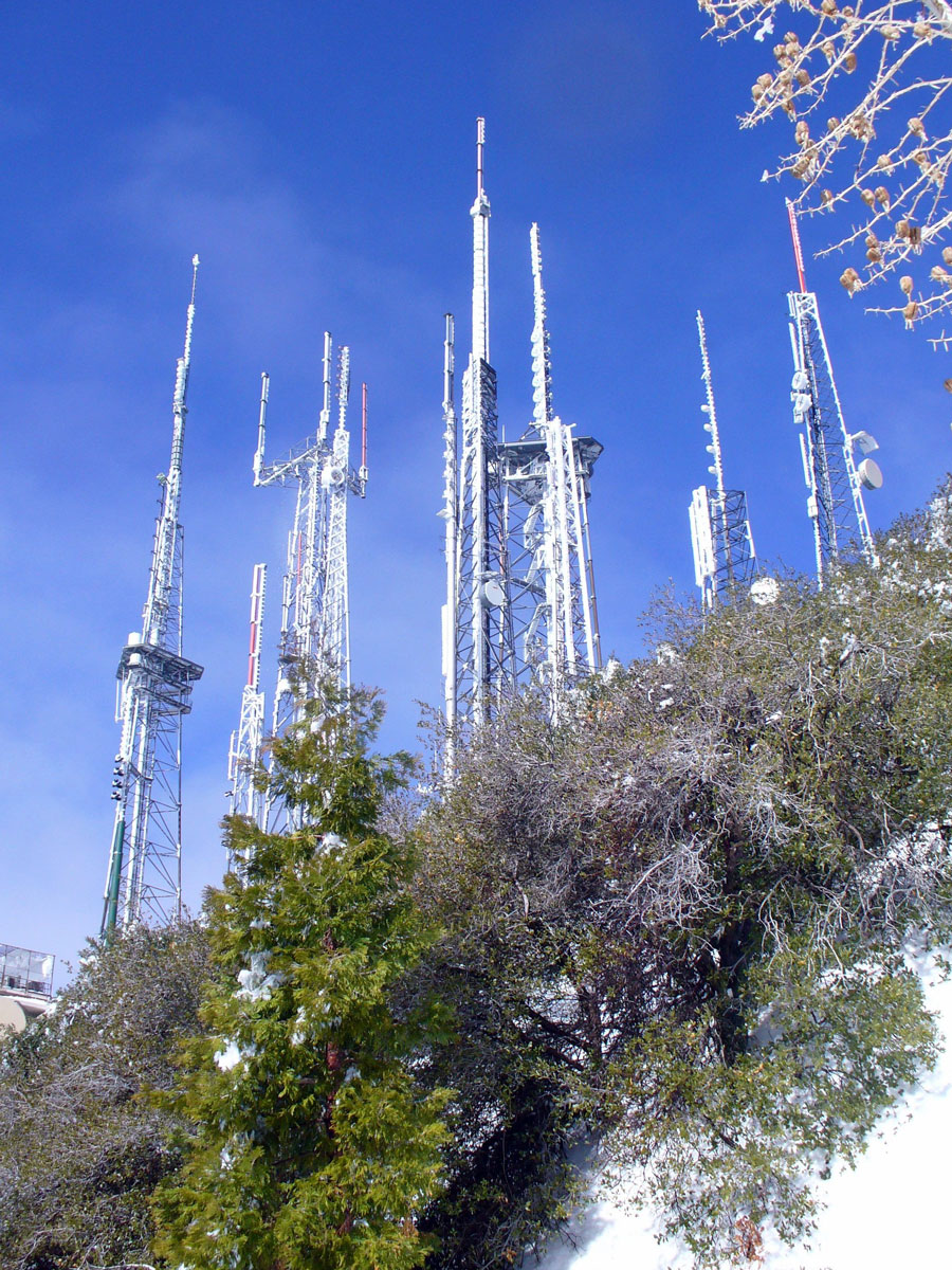
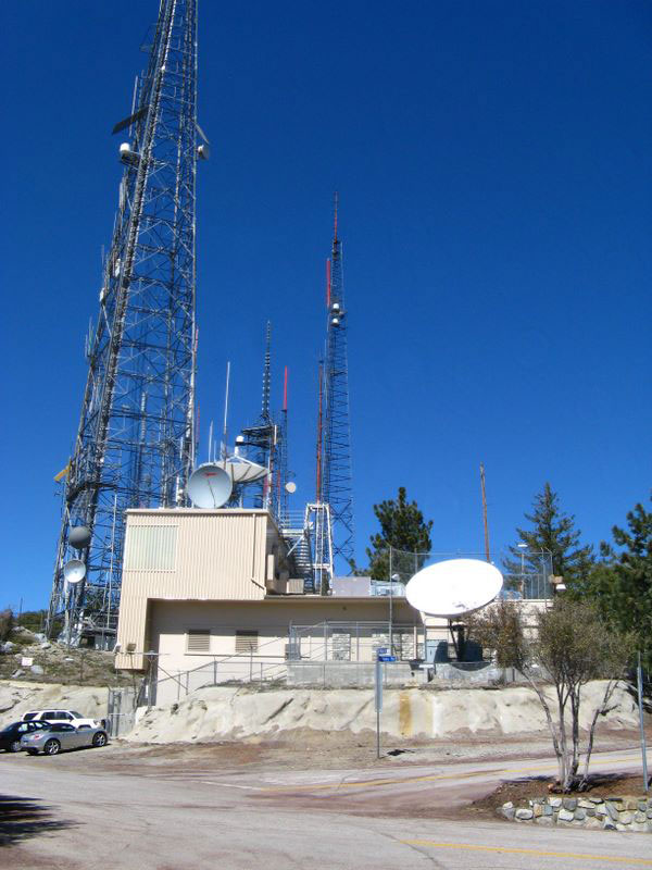
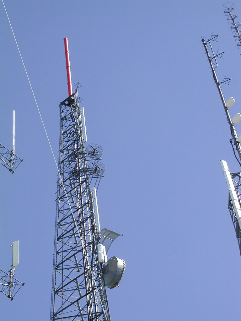
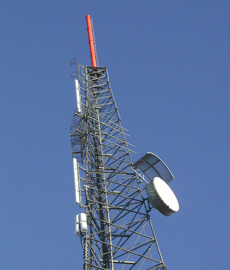
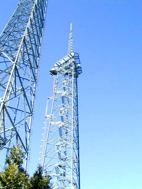
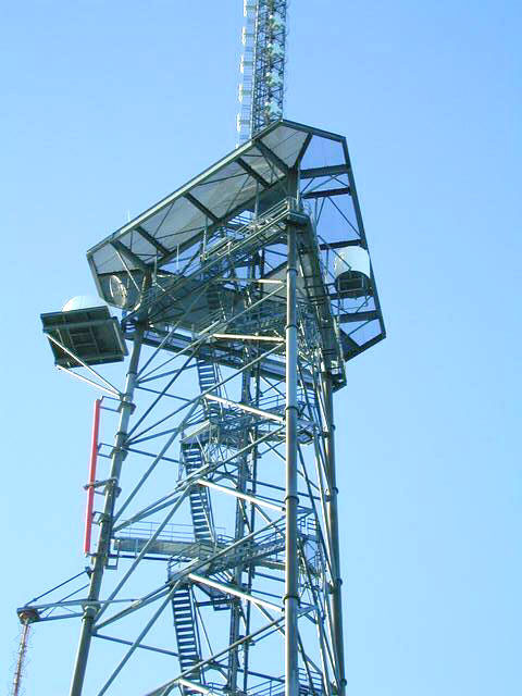
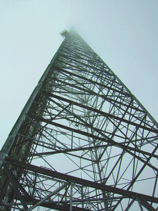
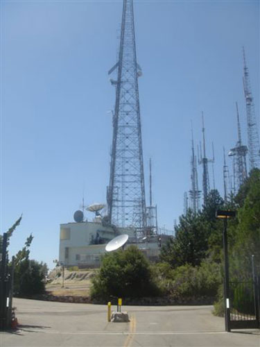
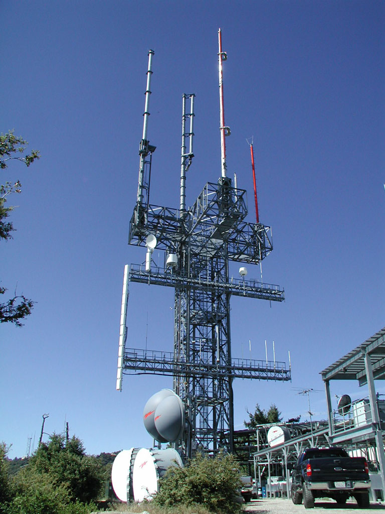
Mt. Wilson transmitter site
Coordinates: 34°13'38" N, 118°04'04" W
Mount Wilson is one of the better known peaks in the San Gabriel Mountains, above Pasadena, part of the Angeles National Forest in Los Angeles County, California. It is the location of the Mount Wilson Electronics Reservation. In 1948 the first television transmitter was installed here. Seeing the future in the new fangled media of TV and FM radio broadcasting, the Metromedia Company bought 720 acres from the Mt. Wilson Hotel Company and started leasing out space for the ever increasing numbers of commercial broadcast antennas. At an average antenna height of 6000 feet above sea level, 5500 feet above metropolitan Los Angeles, and 3000 feet above average terrain, this is a superpower site, with typical coverage footprints of 5000 square miles. The television stations here also have incredible reach because of the height of the site, along with very high effective radiated powers.
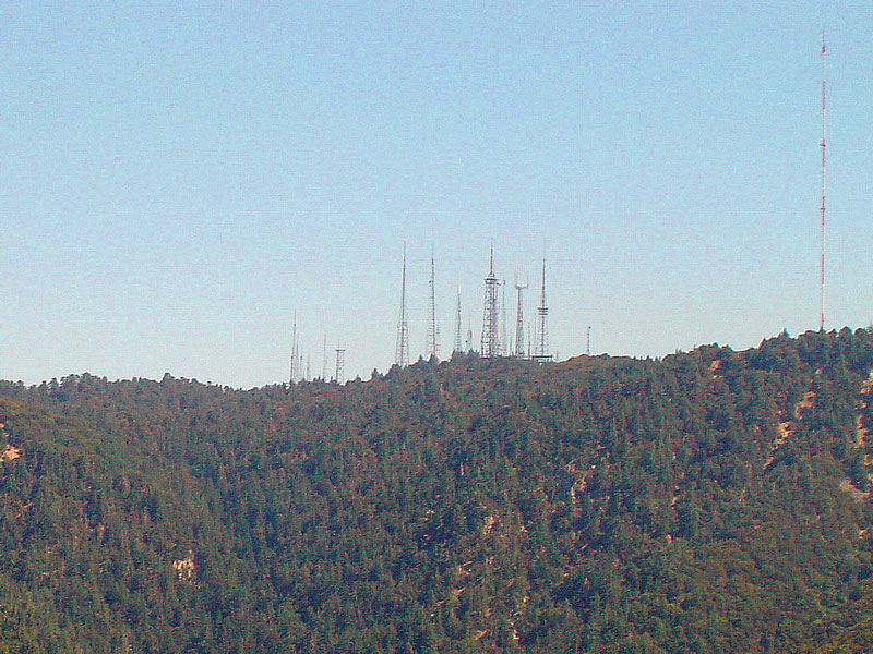
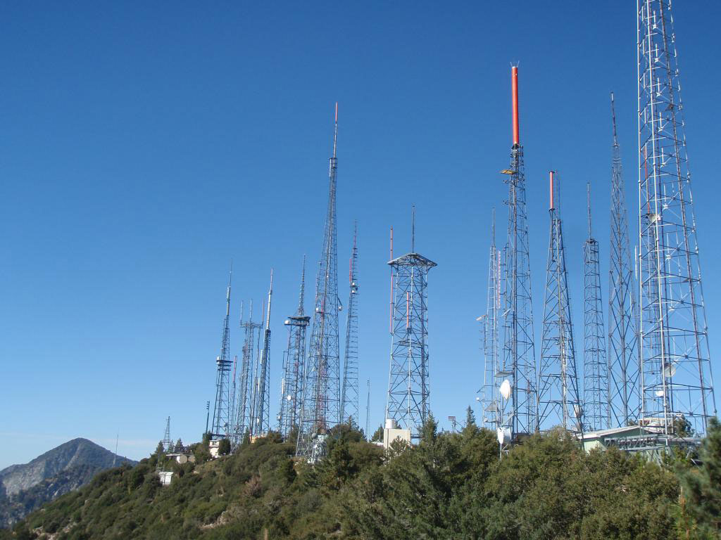
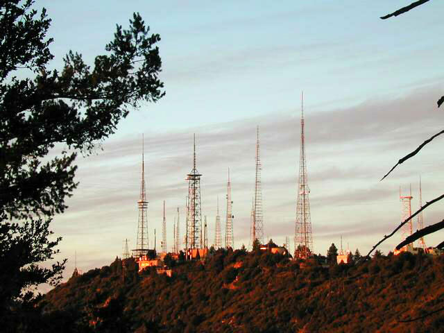
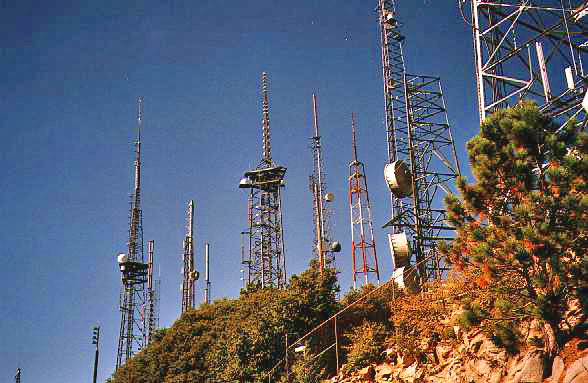


More info: Wikipedia
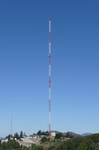
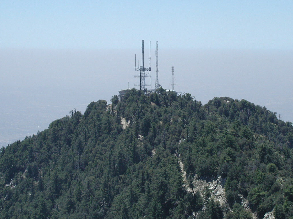
Mt. Harvard transmitter site
Coordinates: 34°12'47" N, 118°03'44" W
Mount Harvard is located about a mile south of Mount Wilson.
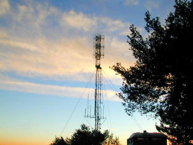
More info: EarthSignals.com (Marvin Collins)
Mt. Lee (Hollywood Sign) transmitter site
Coordinates: 34°08'05" N, 118°19'13" W
Mount Lee is a peak in the Santa Monica Mountains, in Griffith Park in Los Angeles, California, USA. The famous Hollywood Sign is located on its southern slope. The large radio tower atop Mount Lee today is owned and operated by the City of Los Angeles. Smaller tenants on the site have included some federal government and amateur radio users.
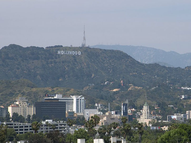

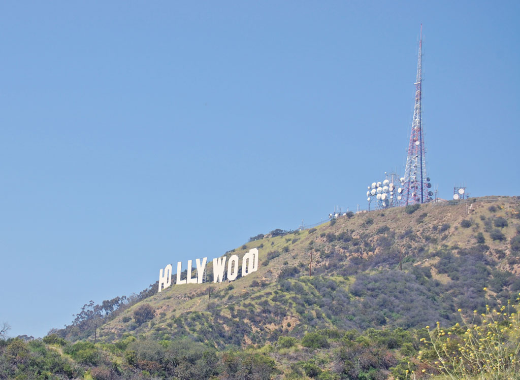


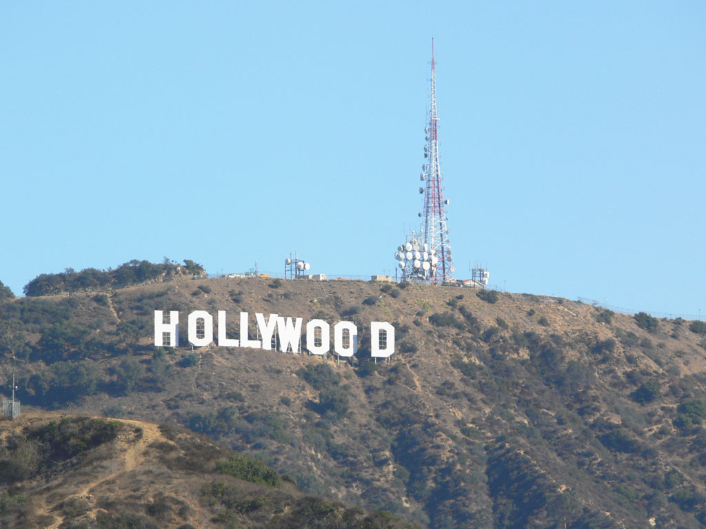
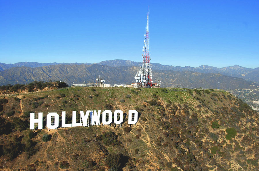
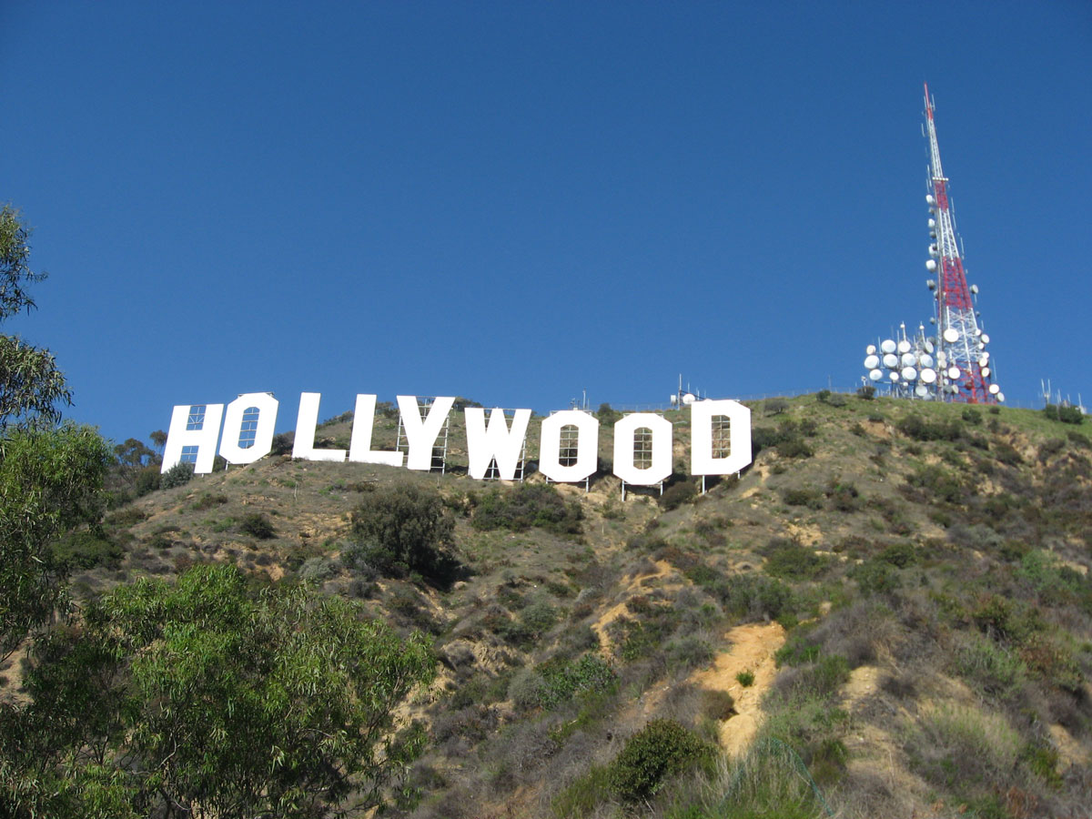
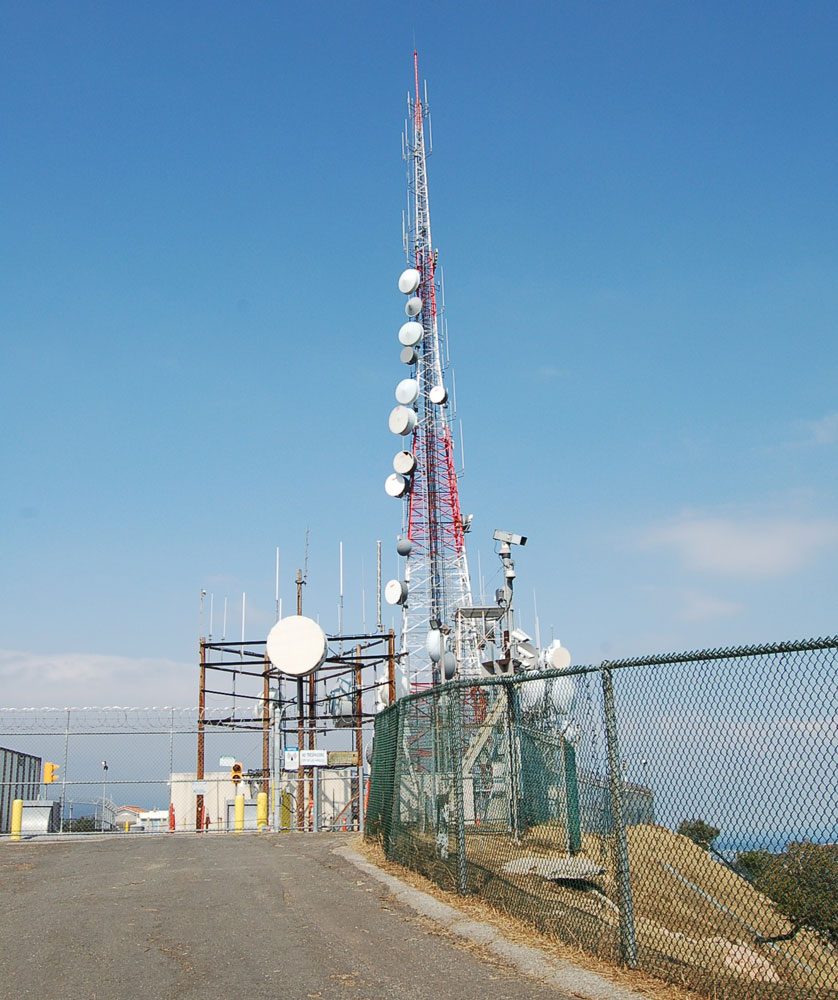

More info: Wikipedia
Useful links
CBA - California Broadcasters Association
SCBA - Southern California Broadcasters Association
California Historical Radio Society
LA Radio by Don Barrett
Radiowatch: Your Guide to Los Angeles Radio
Fybush.com Tower site of the week: California
Tophour.com audio: Los Angeles Legal IDs
RadioDiscussions.com - Los Angeles and Southern California Message Board
RadioDiscussions.com - California Message Board
Los Angeles, California at Radio-Locator.com
