
- World Radio Map • North America • United States • California • Santa Barbara
Radio stations in Santa Barbara, CAEmisoras de radio en Santa Bárbara, CAClick on the radio station name to listen online / Haga clic en el emisora para escuchar en vivo |
||
| FM,MHz | Station | Transmitter |
| 88.7 |
 KDRW Public Radio KDRW Public Radio
└ HD2  Eclectic 24 Eclectic 24
|
Gibraltar Peak |
| 89.9 |
 K210AD LAist K210AD LAist
|
Gibraltar Peak |
| 90.3 |
 KMRO Radio Nueva Vida KMRO Radio Nueva Vida
|
Gibraltar Peak + Ventura, Sulphur Mountain |
| 90.9 |
 K215AG Public Radio K215AG Public Radio
|
Santa Ynez Mountains, Broadcast Peak |
| 91.1 |
 KDSC Classical California KDSC Classical California
|
Ventura, Sulphur Mountain |
| 91.5 |
 K218CP CSN Radio K218CP CSN Radio
|
Gibraltar Peak |
| 91.9 |
 KCSB KCSB
|
Santa Ynez Mountains, Broadcast Peak |
| 92.7 |
 KYRA Air 1 KYRA Air 1
└ HD2  K-Love K-Love
└ HD3  K-Love 2000s K-Love 2000s
|
Santa Monica Mountains, Castro Peak |
| 92.9 |
 KJEE Modern Rock KJEE Modern Rock
|
Gibraltar Peak |
| 93.3 |
K227BI K-Love 2000s
|
Santa Ynez Mountains, Broadcast Peak |
| 93.7 |
KDB Classical California
|
Gibraltar Peak |
| 94.1 |
 K231CR Old School 94.1/1490 K231CR Old School 94.1/1490
|
Rattlesnake Canyon |
| 94.5 |
 KSPE La Musical KSPE La Musical
|
Santa Ynez Mountains, Broadcast Peak |
| 95.1 |
 KBBY The New 95.1 KBBY The New 95.1
|
Oxnard, Laguna Peak |
| 95.9 |
 KCAQ Q95.9 KCAQ Q95.9
|
Ventura, Red Mountain |
| 96.5 |
 KZAA KZAA
|
601 E Montecito St |
| 96.9 |
 K245DD KZSB Radio K245DD KZSB Radio
|
Rattlesnake Canyon |
| 97.5 |
KLSB K-Love
└ HD2 Air 1
└ HD3  K-Love Eras K-Love Eras
|
Santa Ynez Mountains, Broadcast Peak |
| 97.9 |
 K250BS Fox Sports K250BS Fox Sports
|
Gibraltar Peak |
| 98.3 |
 KDAR The Word KDAR The Word
|
Gibraltar Peak + Ventura, Red Mountain |
| 98.7 |
 K254AH Pacifica Radio K254AH Pacifica Radio
|
Gibraltar Peak |
| 99.7 |
 K259BI Quality Rock K259BI Quality Rock
|
Ventura, Red Mountain |
| 99.9 |
KTYD Quality Rock
|
Rattlesnake Canyon |
| 100.7 |
 KHAY Country 100.7 KHAY Country 100.7
|
Ventura, Red Mountain |
| 101.7 |
 KSBL K-Lite KSBL K-Lite
|
W Camino Cielo at shooting range |
| 102.3 |
 K272DT Public Radio K272DT Public Radio
|
Gibraltar Peak |
| 102.9 |
K275BO CSN Radio
|
Santa Ynez Mountains, Broadcast Peak |
| 103.3 |
 KRUZ KRUZ
|
Santa Ynez Mountains, Broadcast Peak |
| 103.7 |
 KMLA La M KMLA La M
|
Ventura, Barlow Canyon Rd |
| 103.9 |
K280FV Air 1
|
W Camino Cielo at shooting range |
| 104.7 |
 KOCP Old School 104.7 KOCP Old School 104.7
|
Ventura, Orcutt Ridge |
| 105.5 |
 KFYV Live 105.5 KFYV Live 105.5
|
Ventura, Red Mountain |
| 105.9 |
 KRAZ Krazy Country KRAZ Krazy Country
|
Santa Ynez Mountains, Broadcast Peak |
| 106.3 |
 KVYB Groovy 106.3 KVYB Groovy 106.3
|
Ventura, Crimea Rd |
| 106.5 |
 K293CK Radio Lazer K293CK Radio Lazer
|
W Camino Cielo at shooting range |
| 106.9 |
K295AH Eclectic 24
|
W Camino Cielo at shooting range |
| 107.1 |
 KSSC José 97.5/107.1 KSSC José 97.5/107.1
|
Ventura, Red Mountain |
| 107.7 |
 KIST Radio Bronco KIST Radio Bronco
|
W Camino Cielo at shooting range |
| WX,MHz | Station | Transmitter |
| 162.400 |
 KIH34 NOAA Weather Radio KIH34 NOAA Weather Radio
|
Santa Ynez Mountains, Broadcast Peak |
| 162.475 |
WWF62 NOAA Weather Radio
|
Santa Ynez Mountains, Broadcast Peak |
| AM,kHz | Station | Transmitter |
| 540 |
 XESURF Radio Zión XESURF Radio Zión
|
Mexico, Tijuana, BC, Dorada |
| 550 |
 KUZZ Country KUZZ Country
|
Bakersfield, CA, S Sterling Rd |
| 600 |
 KOGO NewsRadio KOGO NewsRadio
|
San Diego, CA, Emerald Hills |
| 640 |
 KFI Talk Radio KFI Talk Radio
|
Los Angeles, CA, Buena Park |
| 690 |
 XEWW La Gigante XEWW La Gigante
|
Mexico, Tijuana, BC, Rosarito |
| 710 |
 KSPN ESPN Los Angeles KSPN ESPN Los Angeles
|
Los Angeles, CA, Irwindale |
| 740 |
 KBRT KBrite Radio KBRT KBrite Radio
|
Los Angeles, CA, Santa Ana Mountains, Oak Flat |
| 760 |
 KFMB Talk Radio KFMB Talk Radio
|
San Diego, CA, Mission Gorge |
| 830 |
 KLAA Angels Radio
ESPN Radio KLAA Angels Radio
ESPN Radio
|
Los Angeles, CA, Chino |
| 870 |
 KRLA The Answer KRLA The Answer
|
Los Angeles, CA, Glendale, 4970 Wawona St |
| 910 |
 KOXR La Mexicana KOXR La Mexicana
|
Oxnard, Los Angeles Ave |
| 940 |
 KYNO Oldies KYNO Oldies
|
Fresno, CA, Monson |
| 950 |
 XEKAM Radio Fórmula XEKAM Radio Fórmula
|
Mexico, Tijuana, BC, Rosarito |
| 990 |
KTMS Fox Sports
|
Rattlesnake Canyon |
| 1020 |
 KTNQ Noticias KTNQ Noticias
|
Los Angeles, CA, West Covina, Avocado Heights |
| 1040 |
 WQFI350 Emergency Radio WQFI350 Emergency Radio
|
San Marcos Pass, Painted Cave |
| 1070 |
 KNX News KNX News
|
Los Angeles, CA, Torrance, Columbia Park |
| 1090 |  XEPRS XEPRS |
Mexico, Tijuana, BC, Rosarito, Rancho del Mar |
| 1110 |
 KWVE KWave KWVE KWave
|
Los Angeles, CA, Irwindale |
| 1130 |
 KSDO Radio Inspiración KSDO Radio Inspiración
|
San Diego, CA, Santee |
| 1150 |
 KEIB The Patriot KEIB The Patriot
|
Los Angeles, CA, West Covina, Avocado Heights |
| 1250 |
KZER Radio Lazer
|
Goleta Beach |
| 1290 |
KZSB KZSB Radio
|
East Beach |
| 1340 |
KCLU Public Radio
|
East Beach |
| 1400 |
 KUNX Radio Bronco KUNX Radio Bronco
|
Santa Paula |
| 1410 |
 KTNK Rocket 103.7 KTNK Rocket 103.7
|
Lompoc |
| 1430 |
 KMRB 粤語廣播電臺 KMRB 粤語廣播電臺
|
Los Angeles, CA, East San Gabriel |
| 1490 |
KOSJ Old School 94.1/1490
|
East Beach |
| 1520 |
 KVEN La Voz KVEN La Voz
|
Oxnard, Dodge Rd |
| 1540 |
 KMPC 라디오 코리아 KMPC 라디오 코리아
 KBS 월드 라디오 KBS 월드 라디오
|
Los Angeles, CA, El Sereno |
| 1580 |
 KBLA Talk Radio KBLA Talk Radio
|
Los Angeles, CA, Echo Park |
| 1590 |
KVTA Fox Sports
|
Ventura, Olivas Park Dr |
| 1610 |
 WPYR591 UCSB Campus Radio WPYR591 UCSB Campus Radio
|
Goleta, UC Santa Barbara |
| 1610 |
 WQHK800 Montecito FD Radio WQHK800 Montecito FD Radio
|
Montecito, 595 San Ysidro Rd |
| 1630 |
 XEUT UABC Radio XEUT UABC Radio
|
Mexico, Tijuana, BC, Universidad Autónoma de Baja California |
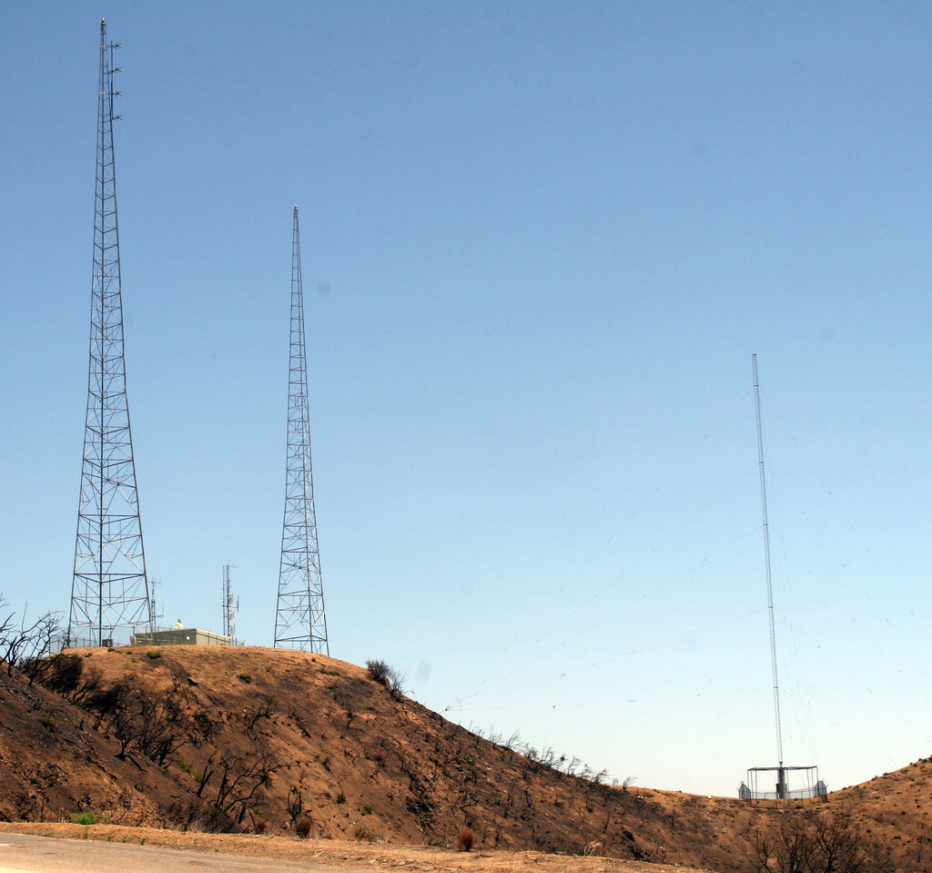
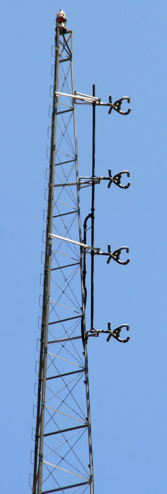
Santa Ynez Mountains, Broadcast Peak
Coordinates: 34°31'36" N, 119°58'19" W
Broadcast Peak, at the very rigde of the Santa Ynez Mountains, above Goleta has an unobstructed view of the entire Santa Barbara County. It is the site of the local television station KEYT-TV (ABC Ch. 3) as well as the university radio station KCSB 91.9 FM. About a quarter mile further west is Santa Ynez Peak, filled with non-broadcast communication towers: microwave links for the county, for AT&T etc.


More info: SBtower.com
Gibraltar Peak and Rattlesnake Canyon
Coordinates: 34°27'57" N, 119°40'40" W
Gibralter Peak antenna farm, above Santa Barbara, California is the location of broadcast towers for many radio stations and television translators. The towers of KTMS-AM and KTYD-FM are located about 1000 feet above and behind the peak farther up Gibraltar Road in the place known as Rattlesnake Canyon.
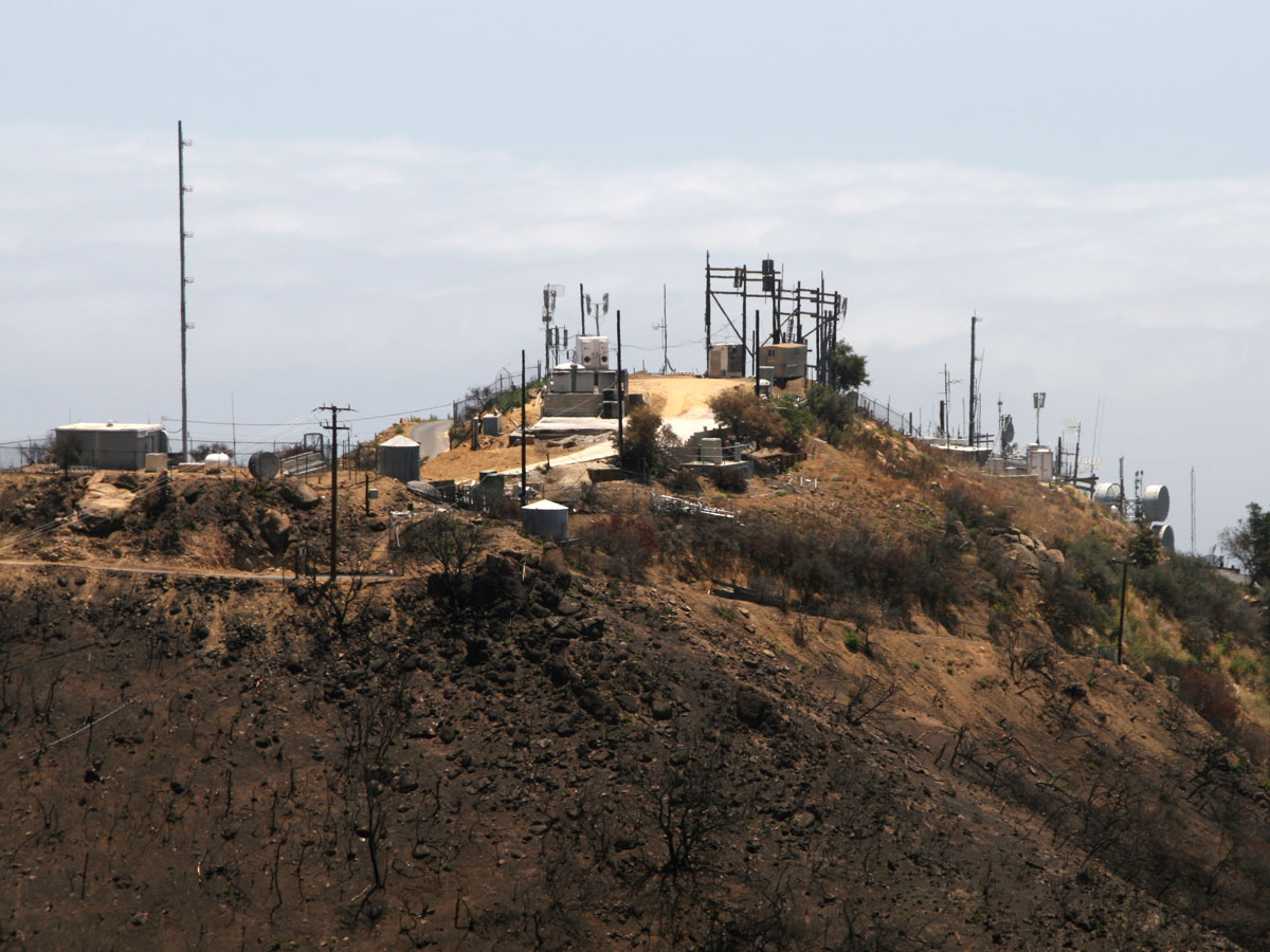
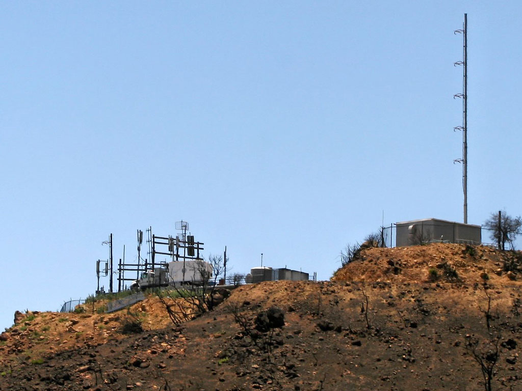
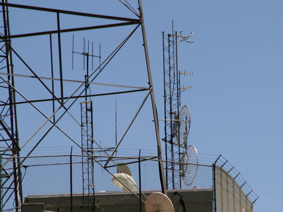
More info: SBtower.com
Useful links
CBA - California Broadcasters Association
SCBA - Southern California Broadcasters Association
California Historical Radio Society
Radiowatch: Your Guide to Los Angeles Radio
Fybush.com Tower site of the week: California
Fybush.com Tower site of the week: The Sites of Santa Barbara
Information Station Specialists Case Study: San Marcos Pass Emergency Radio System 1040 AM
Tophour.com audio: Santa Barbara Legal IDs
RadioDiscussions.com - Los Angeles and Southern California Message Board
RadioDiscussions.com - California Message Board
Santa Barbara, California at Radio-Locator.com
