
- World Radio Map • North America • United States • Massachusetts • Boston
Radio stations in Boston, MAClick on the radio station name to listen online |
||
| FM,MHz | Station | Transmitter |
| 88.1 |
 WMBR WMBR
|
Cambridge, Eastgate Building |
| 88.9 |
 WERS WERS
└ HD2  WERS+ WERS+
└ SCA  Talking Information Center Talking Information Center
└ SCA  Radio Echo Evangélique Radio Echo Evangélique
|
One Financial Center |
| 89.3 |
 WTBU Radio WTBU Radio
|
Boston University Campus (Leaky Feeder) |
| 89.3 |
 WCDV Radio Torrente De Vida WCDV Radio Torrente De Vida
|
Lynn |
| 89.7 |
 WGBH Boston Public Radio WGBH Boston Public Radio
└ HD2  Classical Radio Boston Classical Radio Boston
|
Milton, Blue Hill Observatory |
| 90.3 |
 WZBC WZBC
|
Newton, Boston College Campus |
| 90.9 |
 WBUR Boston's NPR News WBUR Boston's NPR News
└ SCA  Tiếng Nước Tôi Tiếng Nước Tôi
|
Newton American Tower |
| 91.5 |
 WMFO Freeform Radio WMFO Freeform Radio
|
Medford, Tufts University Campus |
| 91.5 |
 WZLY College Radio WZLY College Radio
|
Wellesley, Wellesley College Campus |
| 91.5 |
 WMLN Curry College Radio WMLN Curry College Radio
|
Milton, Curry College Campus |
| 91.9 |
 WUMB Radio WUMB Radio
|
Forbes Hill Water Tower |
| 92.3 |
 WPRO Pro FM WPRO Pro FM
|
Providence, RI, Johnston, Neutaconkanut Hill |
| 92.5 |
 WXRV The River WXRV The River
|
Haverhill + 200 Clarendon St |
| 92.9 |
 WBOS Bloomberg 92.9 WBOS Bloomberg 92.9
└ HD2  Boston's Rock Boston's Rock
|
Prudential Tower |
| 93.3 |
 WSNE Now 93.3 WSNE Now 93.3
└ HD2  WHJJ NewsRadio WHJJ NewsRadio
|
Providence, RI, Rehoboth, 89 Pine St |
| 93.7 |
 WEEI Sports Radio WEEI Sports Radio
|
Peabody, Lakeland Park Dr |
| 94.1 |
 WHJY 94HJY WHJY 94HJY
|
Providence, RI, East Providence |
| 94.5 |
 WJMN Jam'n 94.5 WJMN Jam'n 94.5
└ HD2  Black Information Netw. Black Information Netw.
|
Newton American Tower |
| 94.9 |
 W235CS Mega 96.5 W235CS Mega 96.5
|
Quincy, Quarry Hills |
| 94.9 |
 WZMR Zumix Radio WZMR Zumix Radio
|
East Boston High School |
| 95.3 |
 WHRB Harvard Radio WHRB Harvard Radio
|
One Financial Center |
| 95.5 |
 WLVO K-Love WLVO K-Love
|
Providence, RI, East Providence |
| 95.7 |
 WZID Today's Variety WZID Today's Variety
|
Manchester, NH, South Uncanoonuc Mountain |
| 95.9 |
 WATD South Shore's Radio WATD South Shore's Radio
|
Marshfield, Grove St |
| 96.1 |
 WSRS 96-1 SRS WSRS 96-1 SRS
└ HD2 WTAG NewsRadio
|
Worcester, MA, Paxton, Asnebumskit Hill |
| 96.5 |
W243DC Mega 96.5
|
One Financial Center |
| 96.5 |
W243DC The River
|
Needham, WFXT-TV Tower |
| 96.9 |
 WBQT Hot 96.9 WBQT Hot 96.9
└ HD2  Playa Playa
|
Prudential Tower |
| 97.3 |
 WJFD Rádio 97.3 WJFD Rádio 97.3
 RDP Internacional RDP Internacional
|
New Bedford, Fairhaven |
| 97.5 |
 WOKQ New Country WOKQ New Country
|
Dover, NH, Green Hill |
| 97.7 |
 WZRM Rumba 97.7 WZRM Rumba 97.7
|
Milton, Great Blue Hill |
| 98.5 |
 WBZ The Sports Hub WBZ The Sports Hub
└ HD2  Hubcast Hubcast
|
Newton American Tower |
| 99.1 |
 WPLM Easy 99.1 WPLM Easy 99.1
|
Plymouth, Columbus Rd |
| 99.5 |
WCRB Classical Radio Boston
|
Andover, Bald Hill |
| 99.9 |
 W260DS Latina Boston W260DS Latina Boston
|
200 Clarendon St |
| 100.1 |
 WBRS WBRS
|
Waltham, Brandeis University Campus |
| 100.3 |
 W262CV The Spirit of Boston W262CV The Spirit of Boston
|
Cambridge, Eastgate Building |
| 100.7 |
 WZLX Classic Rock WZLX Classic Rock
└ HD2  The Voice of Boston The Voice of Boston
└ HD3  Talk 1200 Talk 1200
|
Prudential Tower |
| 101.1 |
 W266DQ The Greatest Hits W266DQ The Greatest Hits
|
Weymouth |
| 101.1 |
 WGIR Rock 101 WGIR Rock 101
|
Manchester, NH, South Uncanoonuc Mountain |
| 101.3 |
 W267CE Memories Channel W267CE Memories Channel
|
Cambridge, 443 Concord Ave |
| 101.5 |
 WWBB B101 WWBB B101
└ HD2  TikTok Radio TikTok Radio
|
Providence, RI, Rehoboth, 33 Pine St |
| 101.7 |
 WBWL The Bull WBWL The Bull
└ HD2  Pride Radio Pride Radio
|
Medford, 146 Murray St |
| 102.1 |
 W271CG Renew FM W271CG Renew FM
|
Quincy |
| 102.5 |
 WKLB Country WKLB Country
└ HD2  NuTune Country NuTune Country
|
Needham, WBZ-TV Tower |
| 102.9 |
 WBCA Community Radio WBCA Community Radio
|
Egleston Square, 3025 Washington St |
| 102.9 |
 WBPG Boston Praise Radio WBPG Boston Praise Radio
|
Dorchester |
| 102.9 |
 WLAS Lasell College Radio WLAS Lasell College Radio
|
Newton, Auburndale |
| 103.3 |
 WBGB Big 103 WBGB Big 103
└ HD2  Channel Q Channel Q
|
Newton American Tower |
| 103.7 |
W279BQ Renew FM
|
200 Clarendon St |
| 104.1 |
 WBMX Mix 104.1 WBMX Mix 104.1
└ HD2  WAAF WAAF
└ SCA  Radio María (Español) Radio María (Español)
└ SCA  Radio Voie du Salut Radio Voie du Salut
|
Prudential Tower |
| 104.5 |
 WXLO WXLO
|
Worcester, MA, Leominster |
| 104.9 |
WNKC K-Love
|
Gloucester, 13 Kondelin Rd |
| 104.9 |
 WRBB WRBB
|
Northeastern University Campus |
| 105.1 |
 WWLI Lite 105 WWLI Lite 105
|
Providence, RI, Johnston, Neutaconkanut Hill |
| 105.3 |
 W287CW La Pantera W287CW La Pantera
|
Medford, 146 Murray St |
| 105.7 |
 WROR Classic Hits WROR Classic Hits
|
Prudential Tower |
| 106.1 |
W291CZ Boston's Rock
|
200 Clarendon St |
| 106.7 |
 WMJX Magic 106.7 WMJX Magic 106.7
|
Prudential Tower |
| 107.3 |
WKVB K-Love
└ HD2  Air 1 Air 1
└ HD3  K-Love Eras K-Love Eras
|
Marlborough + John Hancock Tower + Lexington + Waltham |
| 107.9 |
 WXKS Kiss 108 WXKS Kiss 108
└ HD2  WBZ Newsradio WBZ Newsradio
|
Prudential Tower |
| WX,MHz | Station | Transmitter |
| 162.425 |
 WNG574 NOAA Weather Radio WNG574 NOAA Weather Radio
|
Gloucester |
| 162.475 |
KHB35 NOAA Weather Radio
|
Milton, Great Blue Hill |
| 162.500 |
KZZ41 NOAA Weather Radio
|
Mount Washington, NH |
| 162.550 |
WXL93 NOAA Weather Radio
|
Worcester, MA, Paxton, Asnebumskit Hill |
| AM,kHz | Station | Transmitter |
| 530 |
 WQFV858 Hwy Advisory Radio WQFV858 Hwy Advisory Radio
|
I-90, I-93 |
| 550 |
 WSJW Relevant Radio WSJW Relevant Radio
|
Providence, RI, Valley Falls |
| 560 |
 WGAN NewsRadio WGAN NewsRadio
|
Portland, ME, 236 Lane Ave |
| 580 |
WTAG NewsRadio
|
Worcester, MA, Holden |
| 590 |
 WEZE The Word WEZE The Word
|
Medford, Commercial St |
| 630 |
 WPRO News Talk WPRO News Talk
|
Providence, RI, Riverside, Wampanoag Trl |
| 640 |
WTBU Radio
|
Boston University Campus (Carrier current) |
| 660 |
 WFAN Sports Radio WFAN Sports Radio
|
New York, NY, The Bronx, High Island |
| 680 |
WRKO The Voice of Boston
|
Burlington, Meadow Rd |
| 710 |
 WOR The Voice of New York WOR The Voice of New York
|
New York, NY, Lyndhurst, NJ |
| 720 |
WJIB Memories Channel
|
Cambridge, 443 Concord Ave |
| 760 |
 WVNE Life Changing Radio WVNE Life Changing Radio
|
Worcester, MA, North Brookfield |
| 770 |
 WABC WABC
|
New York, NY, Lodi, NJ |
| 790 |
 WPRV The Score WPRV The Score
|
Providence, RI, Omega Pond |
| 800 |
 WNNW Power 800 WNNW Power 800
|
Lawrence |
| 810 |
 WGY News Talk WGY News Talk
|
Albany, NY, Rotterdam, I-90 exit 25A |
| 830 |
 WCRN News Talk WCRN News Talk
|
Worcester, MA, Leicester |
| 850 |
 WEEI WEEI
|
Needham, 1555 Central Ave |
| 880 |
 WHSQ ESPN New York 880 WHSQ ESPN New York 880
|
New York, NY, The Bronx, High Island |
| 890 |
WAMG Mega 96.5
|
Holliston, Sewell St |
| 920 |
WHJJ NewsRadio
|
Providence, RI, Riverside, Wampanoag Trl |
| 950 |
WROL The Spirit of Boston
|
Saugus, Salem Turnpike |
| 980 |
 WCAP Voice of the Valley WCAP Voice of the Valley
|
Lowell, Pawtucketville |
| 1030 |
WBZ Newsradio
|
Hull, Newport Rd |
| 1060 |
 WQOM The Station of the Cross WQOM The Station of the Cross
 EWTN Catholic Radio EWTN Catholic Radio
|
Holliston, Sewell St |
| 1080 |
 WTIC News Talk WTIC News Talk
|
Hartford, CT, Avon Mountain, 375 Deercliff Rd |
| 1090 |
WILD Life Changing Radio
|
Medford, Wellington Station |
| 1120 |
 WBNW Money Matters Radio WBNW Money Matters Radio
|
West Concord, Acton, Knox Trl |
| 1130 |
WBBR Bloomberg Radio
|
New York, NY, Carlstadt, NJ |
| 1150 |
WWDJ Relevant Radio
|
Belmont, 75 Concord Ave |
| 1170 |
WFPB WUMB Radio
|
Orleans |
| 1200 |
WXKS Talk 1200
|
Newton, 750 Saw Mill Brook Pkwy |
| 1230 |
 WESX Radio Vida WESX Radio Vida
|
West Lynn, Western Ave |
| 1260 |
 WBIX Nossa Rádio WBIX Nossa Rádio
|
Quincy, Harriet St |
| 1300 |
WJDA Latina Boston
|
Quincy, Palmer St |
| 1330 |
WRCA Boston's Rock
|
Newton, 750 Saw Mill Brook Pkwy |
| 1360 |
 WLYN Multicultural Radio WLYN Multicultural Radio
|
West Lynn, Western Ave |
| 1390 |
WPLM Easy 99.1
|
Plymouth |
| 1400 |
 WLLH Mega 95.1 WLLH Mega 95.1
|
Lawrence |
| 1430 |
 WKOX La Verdad WKOX La Verdad
|
Medford, Wellington Station |
| 1440 |
 WVEI Sports Radio WEEI WVEI Sports Radio WEEI
|
Worcester, MA, 181 Moreland St |
| 1470 |
WAZN Multicultural Radio
|
Belmont, 75 Concord Ave |
| 1490 |
 WCCM Qué Onnda WCCM Qué Onnda
|
Haverhill |
| 1510 |
WMEX The Greatest Hits
|
Quincy, Harriet St |
| 1530 |
 WVBF
Talking Information Center WVBF
Talking Information Center
|
Taunton |
| 1550 |
 WNTN Global Echoes WNTN Global Echoes
|
Auburndale, 143 Rumford Avenue |
| 1570 |
WUBG La Pantera
|
Lawrence |
| 1600 |
 WUNR International Radio WUNR International Radio
|
Newton, 750 Saw Mill Brook Pkwy |
| 1650 |
 WQBQ732 BOS Airport Radio WQBQ732 BOS Airport Radio
|
Logan International Airport |
| Online | Station | |
 LAB Radio LAB Radio
|
||
|
WCRB Bach Channel
|
||
|
WCRB BSO Channel
|
||
|
WUMB Acoustic Music Camps
|
||
|
WUMB Blues
|
||
|
WUMB Celtic Journey
|
||
|
WUMB Contemporary Folk
|
||
|
WUMB L’Air du Temps
|
||
|
WUMB Holiday
|
||
 WGBH PBS GBH 2
 WBZ CBS 4 Boston
 WCVB ABC 5 Boston
 WHDH 7
 WBTS NBC 10 Boston
 WFXT Fox 25 Boston
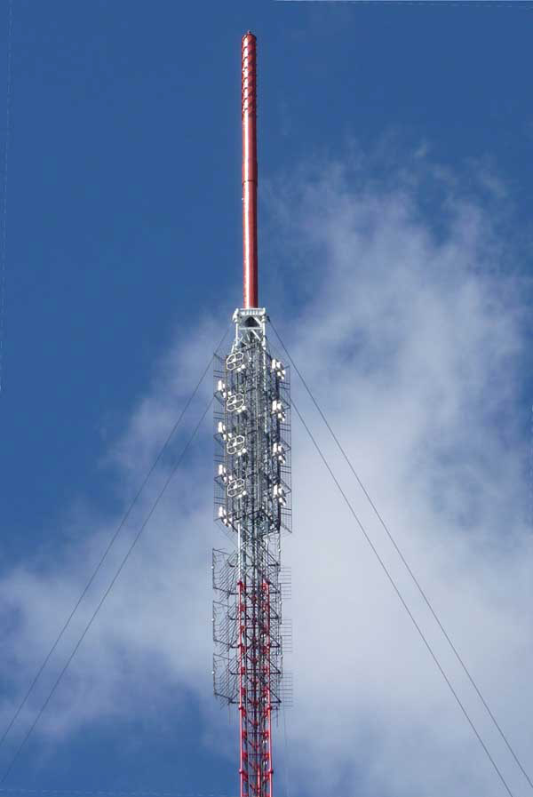
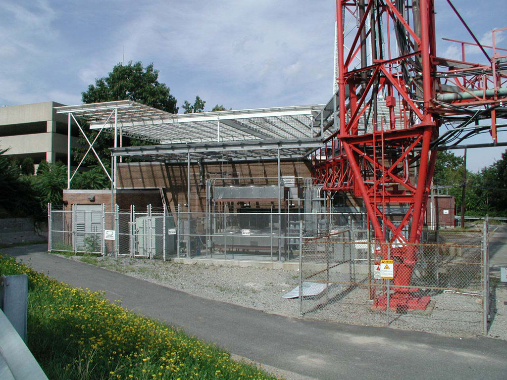
Prudential Tower
Coordinates: 42°20'50" N, 71°04'57" W
The Prudential Tower, also known as the Prudential Building, is a skyscraper in Boston, Massachusetts. The building, a part of the Prudential Center complex, currently stands as the 2nd-tallest building in Boston, behind the John Hancock Tower. Completed in 1964, the building is 749 feet (228 m) tall, with 52 floors. Including its radio mast, the tower stands as the tallest building in Boston and is tied with others as the 77th-tallest in the United States, rising to 907 feet (276 m) in height.
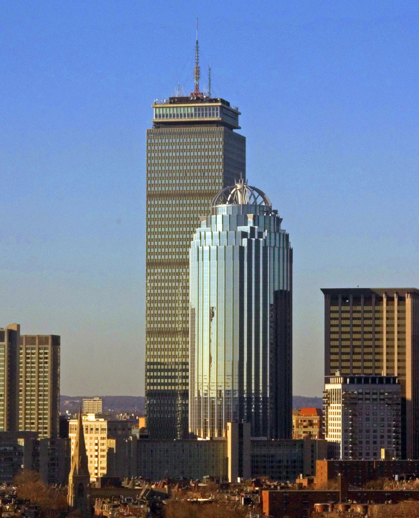

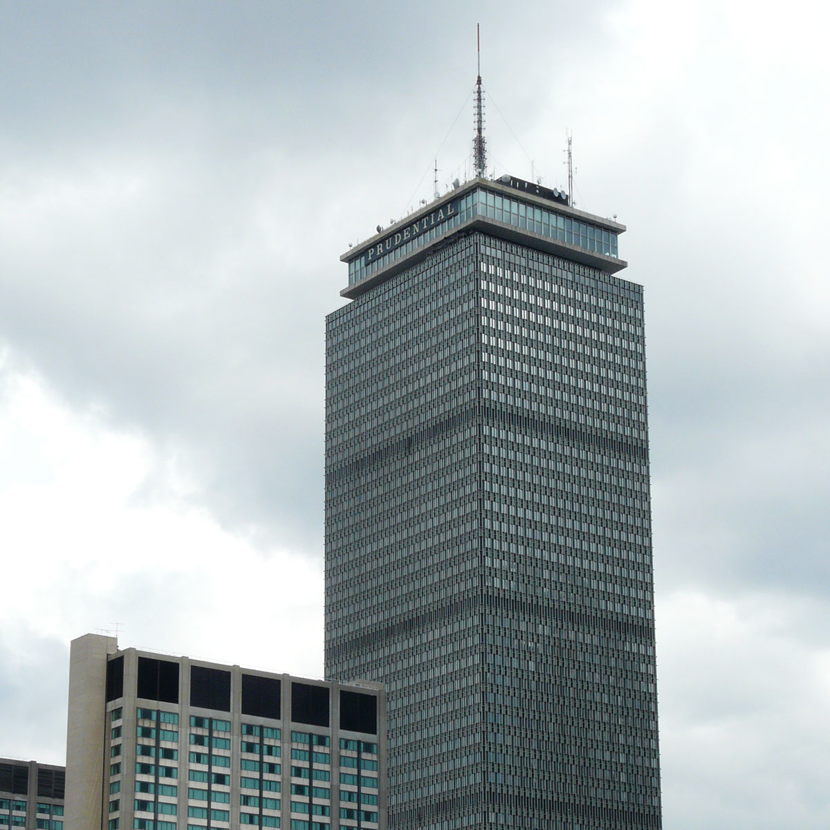
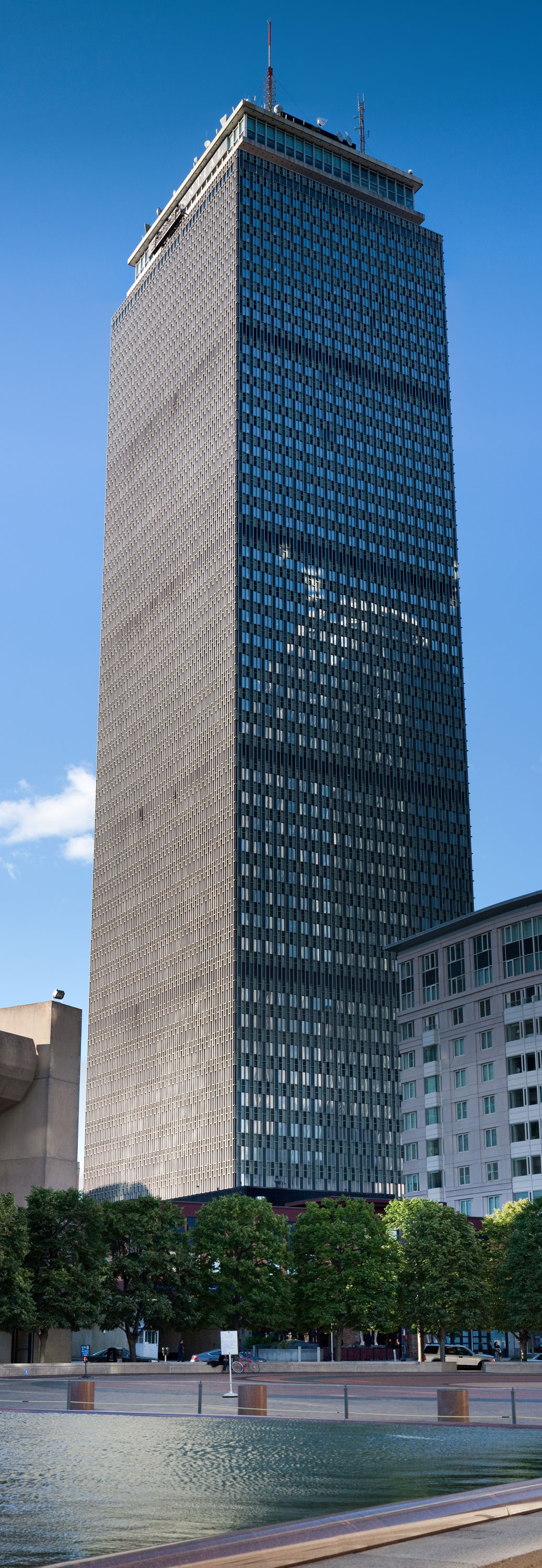
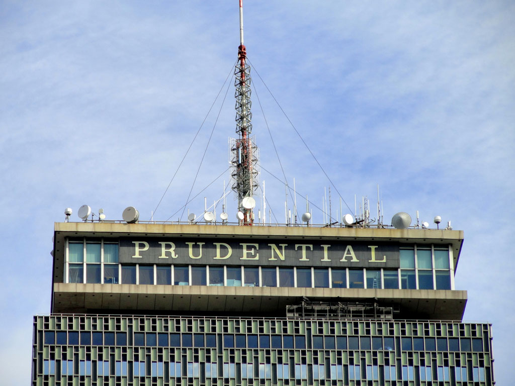
More info: Wikipedia
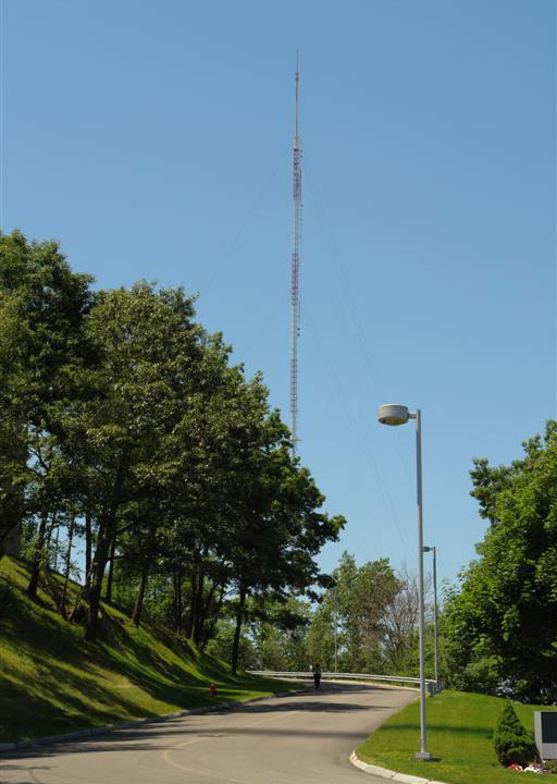
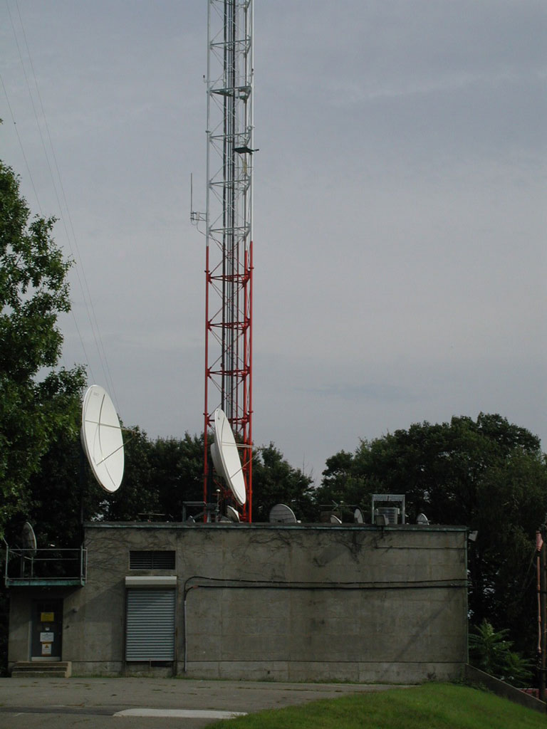
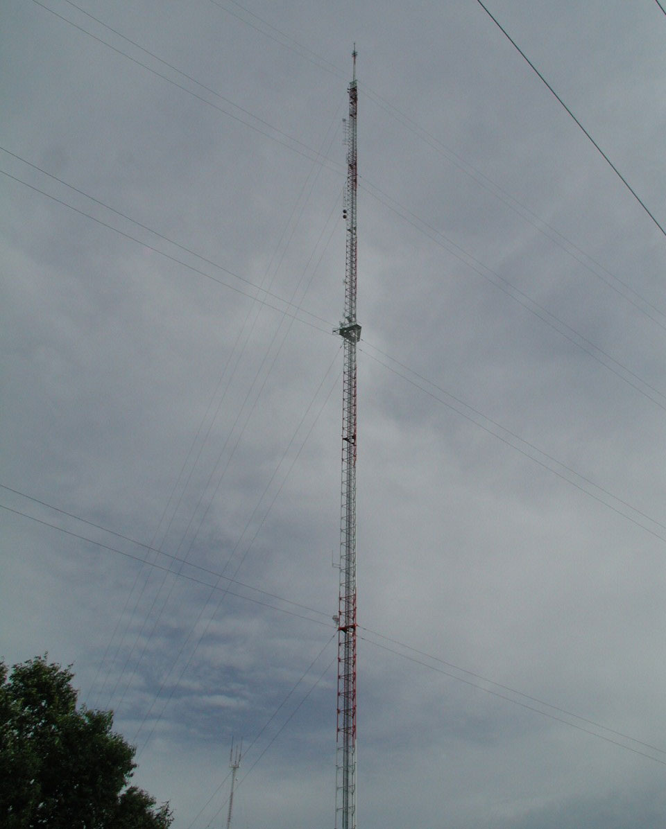
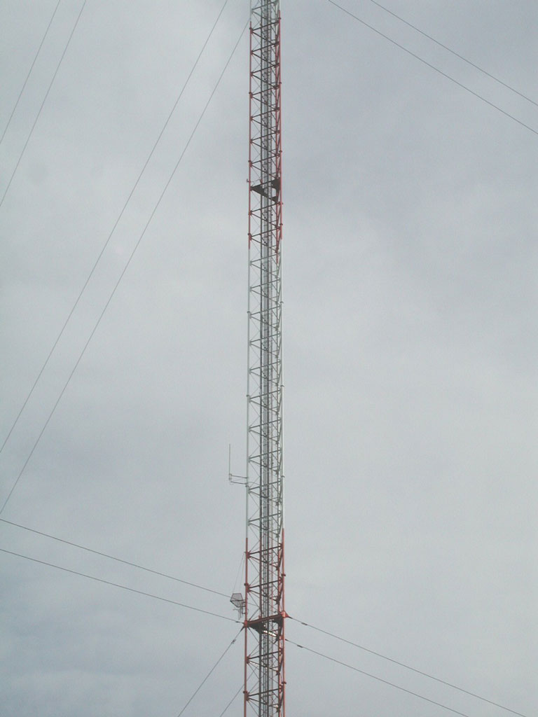
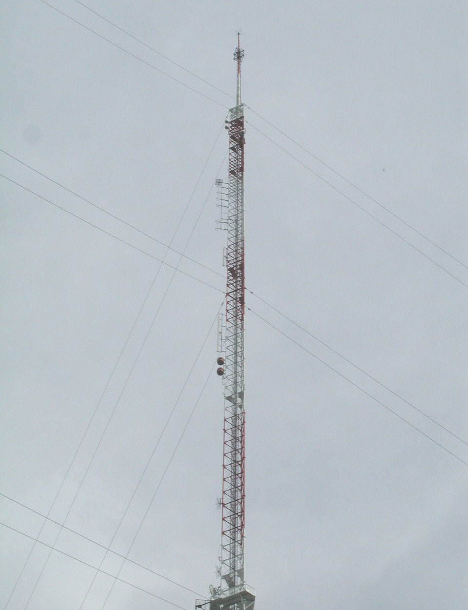
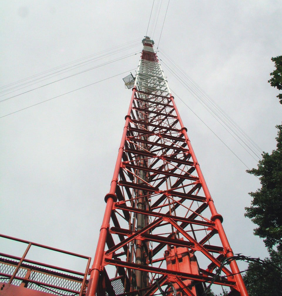
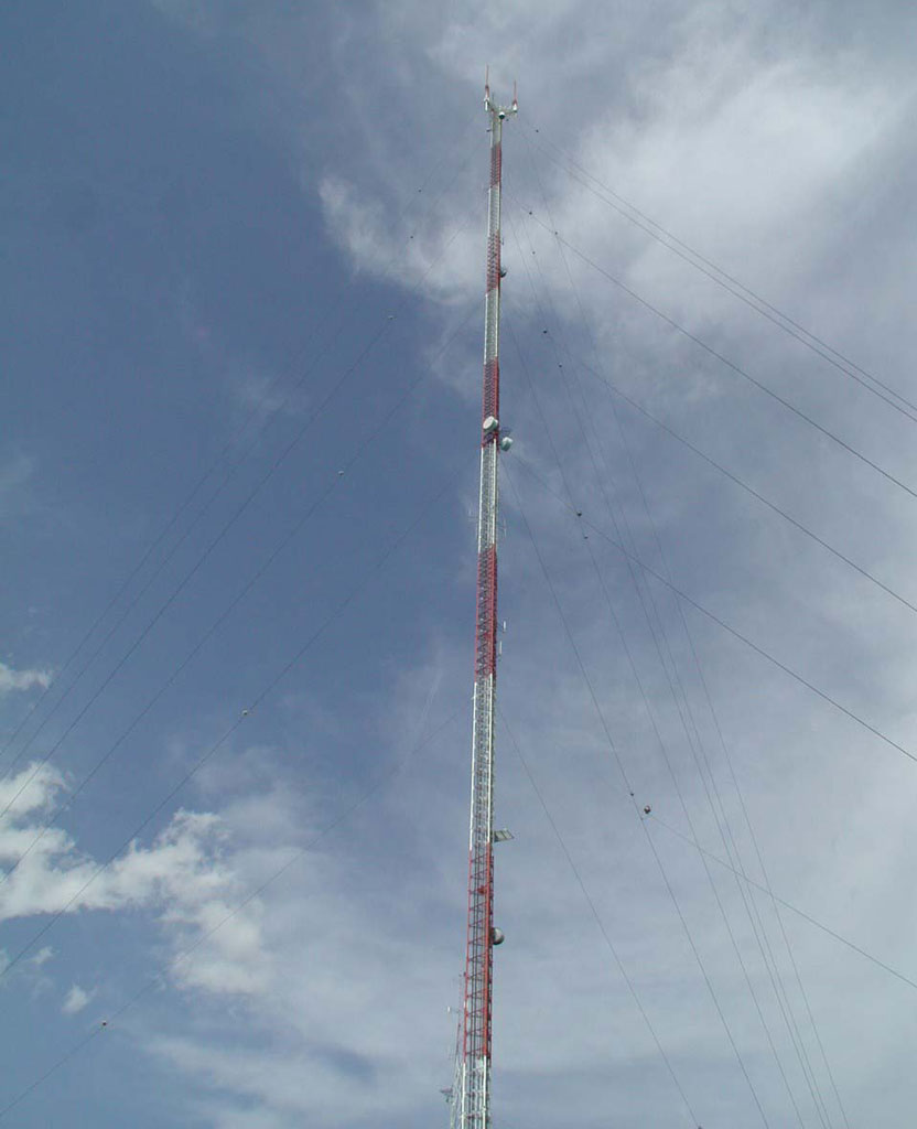
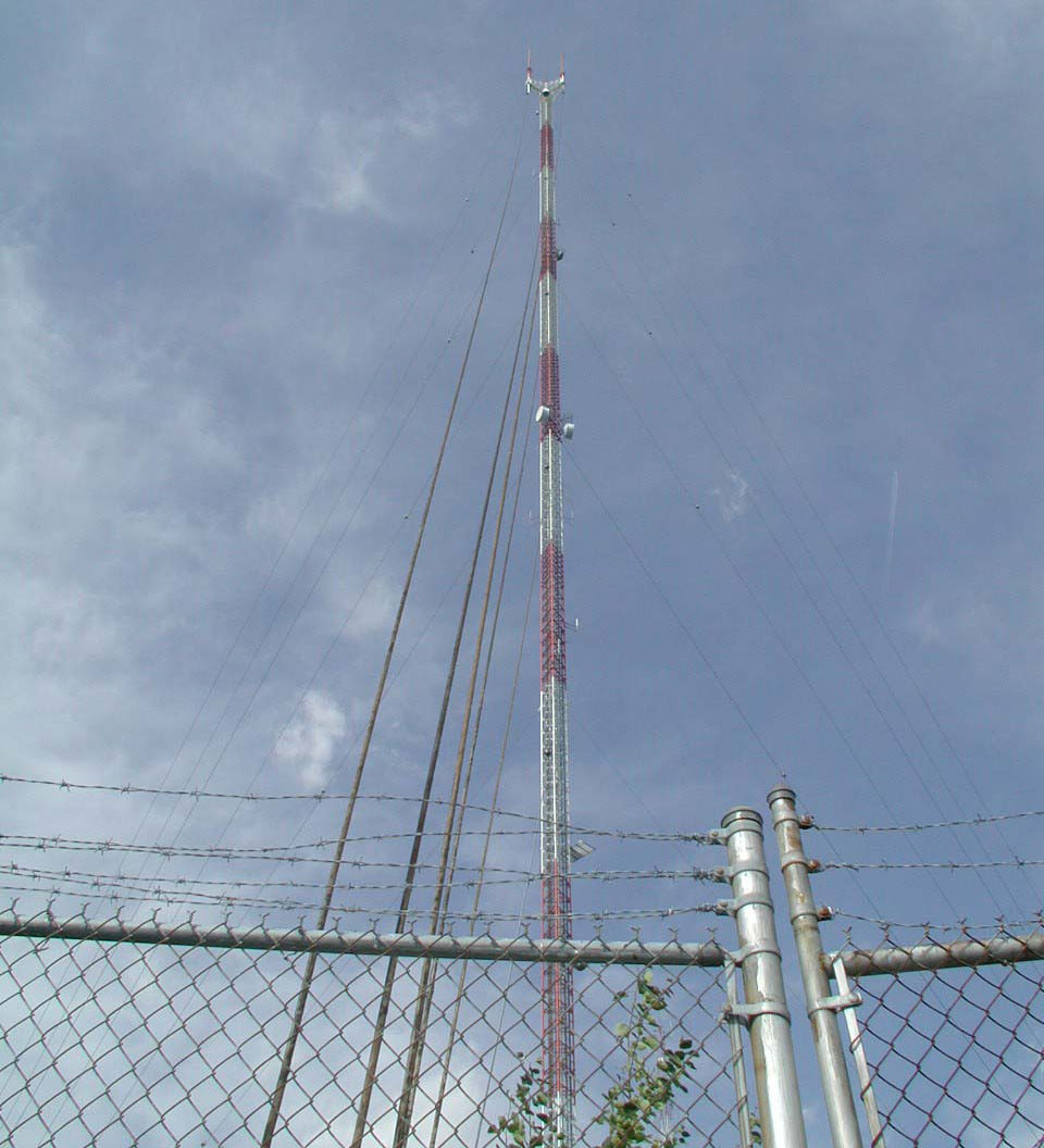
Newton American Tower
Coordinates: 42°18'27" N, 71°13'23" W
American Tower Corp. guyed mast at 1165 Chestnut Street in Newton, Massachusetts.


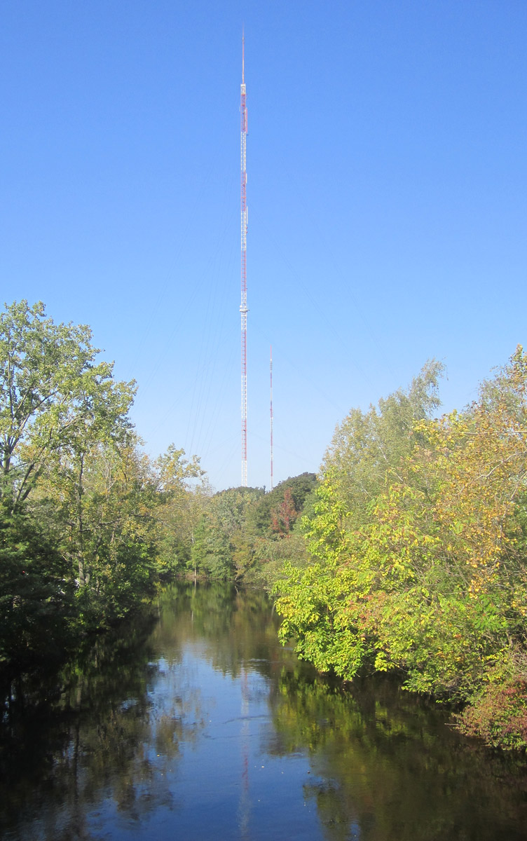
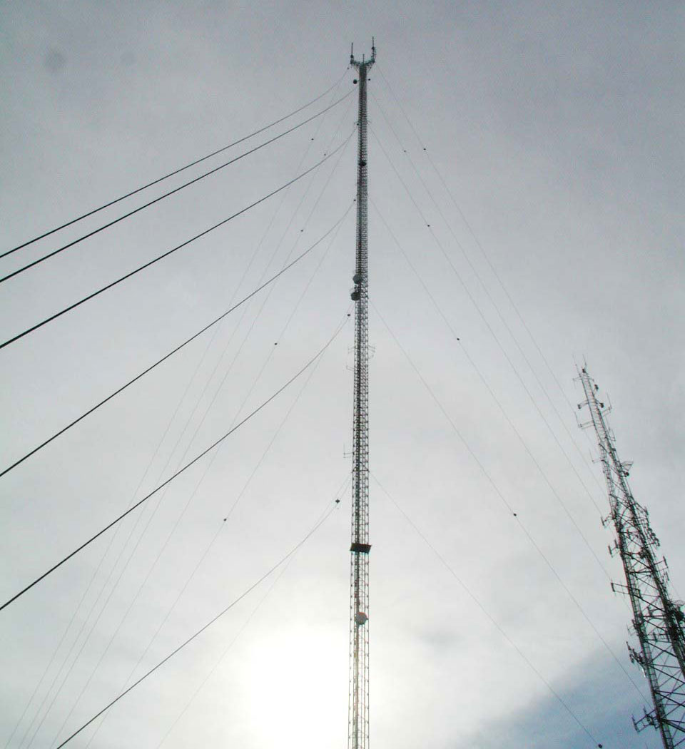
Needham, WBZ-TV Tower
Coordinates: 42°18'38" N, 71°14'10" W
WBZ-TV (CBS Ch.4) / WGBH-TV (PBS Ch.2) / WCVB-TV (ABC Ch.5) / WGBX-TV (PBS Ch.44) guyed mast at 350 Cedar Street in Needham, Massachusetts. Built in 1957 by WBZ-TV, now owned by American Tower Corp.
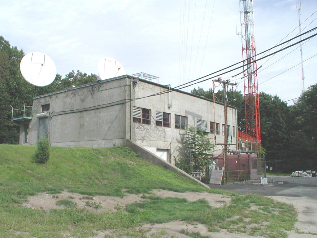
Needham, WFXT-TV Tower
Coordinates: 42°18'10" N, 71°13'04" W
WFXT-TV Tower (Fox Ch.25) / WLVI-TV (CW Ch.56) candelabra guyed mast at 140 Cabot Street in Needham, Massachusetts. Built in 2005, owned by American Tower Corp.


Useful links
MBA - Massachusetts Broadcasters Association
BADX - Boston Area DXers
The Archives @ BostonRadio.org
NECRAT - Boston, Massachusetts radio stations
NEAR-Fest - The New England Amateur Radio Festival
Fybush.com - NorthEast Radio Watch
Fybush.com Tower site of the week: WGBH-FM Blue Hill
Tophour.com audio: Boston Legal IDs
RadioDiscussions.com - Boston, Worcester, and Cape Cod Message Board
RadioDiscussions.com - Massachusetts Message Board
Boston, Massachusetts at Radio-Locator.com
