
- World Radio Map • North America • United States • North Dakota • Fargo
Radio stations in Fargo, NDClick on the radio station name to listen online |
||
| FM,MHz | Station | Transmitter |
| 88.1 |
 KPPP KPPP
|
315 Main Ave |
| 88.7 |
 KFBN Heaven 88.7 KFBN Heaven 88.7
|
Amenia |
| 89.1 |
 KNNZ Ken's FM KNNZ Ken's FM
|
Barnsville, MN |
| 89.5 |
 KFAA Air 1 KFAA Air 1
|
West Fargo, 126 6th St W |
| 90.3 |
 KCCD MPR News KCCD MPR News
|
Sabin, MN, Cnty Hwy 10 |
| 91.1 |
 KCCM YourClassical MPR KCCM YourClassical MPR
|
Sabin, MN, Cnty Hwy 10 |
| 91.9 |
 KDSU Prairie Public Radio KDSU Prairie Public Radio
└ HD2 Roots, Rock and Jazz
|
Amenia |
| 92.7 |
 K288FF The Bison K288FF The Bison
 Fox Sports Radio Fox Sports Radio
|
Lashkowitz High Rise |
| 92.9 |
 KKXL XL93 KKXL XL93
|
Grand Forks, ND, East Grand Forks, MN, 140th St SW |
| 93.1 |
 K226CL WDAY News Talk K226CL WDAY News Talk
|
4500 S University Dr |
| 93.7 |
 KOYY Y94 KOYY Y94
|
Amenia |
| 94.1 |
 K231CV The Mighty 790 K231CV The Mighty 790
|
Moorhead, MN, Cr 75, Midwest Communications Tower |
| 94.5 |
 K233CY The City K233CY The City
|
Westgate, 2720 7th Ave S |
| 95.1 |
 KBVB Bob FM KBVB Bob FM
└ HD2 The City
|
Moorhead, MN, Cr 75, Midwest Communications Tower |
| 95.9 |
 KRFF Radio Free Fargo KRFF Radio Free Fargo
|
315 Main Ave |
| 96.3 |
 KNDS Radio For Everyone KNDS Radio For Everyone
|
West Fargo, 413 Main Ave W |
| 96.9 |
 W245CM Hits FM W245CM Hits FM
|
Westgate, 2720 7th Ave S |
| 97.9 |
 KFNW Life 97.9 KFNW Life 97.9
|
Amenia |
| 98.3 |
 K252GC Real Presence Radio K252GC Real Presence Radio
 EWTN Catholic Radio EWTN Catholic Radio
|
4500 S University Dr |
| 98.7 |
 KLTA Big 98.7 KLTA Big 98.7
└ HD2 Hits FM
|
Sabin, MN, Cnty Hwy 10 |
| 99.3 |
 K257EP K-Love K257EP K-Love
|
Moorhead, MN, 1700 25th St S |
| 99.9 |
 KVOX Froggy KVOX Froggy
|
Moorhead, MN, Cr 75, Midwest Communications Tower |
| 100.7 |
KLDQ K-Love
|
Gardner |
| 101.9 |
 KRWK Jack FM KRWK Jack FM
|
Amenia |
| 102.3 |
 KRCQ Real Country KRCQ Real Country
|
Detroit Lakes, MN, 305th Ave |
| 102.5 |
 K273DJ Faith Radio K273DJ Faith Radio
|
Stanley, 6120 53rd St NW |
| 103.3 |
 KZCR Z-103.3 KZCR Z-103.3
|
Fergus Falls, MN, Rothsay |
| 103.9 |
 KZTK The Truck KZTK The Truck
|
Erie |
| 104.1 |
 KBOT The Wave KBOT The Wave
|
Detroit Lakes, MN, Adams Rd |
| 104.7 |
KMJO The Mighty 790
|
Ayr, 146th Ave SE |
| 105.1 |
 KQWB Q105.1 Rocks KQWB Q105.1 Rocks
|
Wolverton, MN, Cnty Rd 182 |
| 106.1 |
 KQLX Thunder 106.1 KQLX Thunder 106.1
|
Chaffee, 46th St SE |
| 106.5 |
 KRJB KRJB
|
Ada, MN |
| 106.9 |
 KEGK The Eagle KEGK The Eagle
|
Wolverton, MN, Cnty Rd 182 |
| 107.3 |
 K297BW KNFL The Fan K297BW KNFL The Fan
 ESPN Radio ESPN Radio
|
Moorhead, MN, Cr 75, Midwest Communications Tower |
| 107.9 |
 KPFX The Fox KPFX The Fox
└ HD2 The Bison
|
Wolverton, MN, Cnty Rd 182 |
| WX,MHz | Station | Transmitter |
| 162.450 |
 WNG610 NOAA Weather Radio WNG610 NOAA Weather Radio
|
Waubun, MN |
| 162.475 |
WXK42 NOAA Weather Radio
|
Amenia |
| AM,kHz | Station | Transmitter |
| 530 |
 WNWM881 Cass County Radio WNWM881 Cass County Radio
|
West Fargo, Red River Valley Fairgrounds |
| 550 |
 KFYR KFYR
|
Bismarck, ND, Menoken, 185th St NE |
| 570 |
 WNAX WNAX
|
Yankton, SD, 309th St and 444th Ave |
| 600 |
 KSJB Classic Country KSJB Classic Country
|
Jamestown, 83rd Ave SE |
| 680 |
 CJOB CJOB
|
Canada, Winnipeg, MB, Floodway Rd |
| 710 |
KXMR Fox Sports 710
|
Bismarck, ND, Menoken, 2800 171st St NE (daytime) / Hwy 1806 at Schmidt Bottoms (nighttime) |
| 740 |
KNFL The Fan
ESPN Radio
|
Hawley, MN, Cnty Hwy 26 |
| 790 |
KFGO The Mighty 790
|
1020 25th St S |
| 830 |
 WCCO News Talk WCCO News Talk
|
Minneapolis, MN, Coon Rapids |
| 870 |
 KPRM KPRM
|
Park Rapids, MN |
| 890 |
 KQLX Ag News KQLX Ag News
|
Kindred, 157th Ave SE |
| 970 |
WDAY News Talk
|
Barnesville, MN |
| 990 |
 CBW CBC Radio One CBW CBC Radio One
|
Canada, Winnipeg, MB, Springstein |
| 1020 |
 KJJK Channel 97.7 KJJK Channel 97.7
|
Fergus Falls, MN, Cnty Rd 33 |
| 1100 |
 WZFG The Flag WZFG The Flag
|
Sabin, MN, 90th Ave S |
| 1200 |
KFNW Faith Radio
|
5702 52nd Ave S |
| 1250 |
 KBRF Talk Radio KBRF Talk Radio
|
Fergus Falls, MN, 19th St |
| 1280 |
KVXR Real Presence Radio
EWTN Catholic Radio
|
Moorhead, MN, 800 50th Ave S |
| 1310 |
 KNOX News Radio KNOX News Radio
|
Grand Forks, ND, Cnty Rd 9 |
| 1340 |
 KDLM KDLM
|
Detroit Lakes, MN, Cnty Hwy 21 |
| 1370 |
KWTL Real Presence Radio
EWTN Catholic Radio
|
Grand Forks, ND, 32nd Ave S |
| 1400 |
KQDJ ESPN Jamestown
|
Jamestown |
| 1450 |
 KBMW News KBMW News
|
Breckenridge, MN |
| 1490 |
 KOVC KOVC
|
Valley City |
| 1500 |
 KMSC Dragon Radio KMSC Dragon Radio
|
Moorhead, MN, Minnesota State University (Carrier current) |
| 1520 |
 KMSR KMSR
|
Mayville |
| 1590 |
 KGFK Rock 95 KGFK Rock 95
|
Grand Forks, ND, East Grand Forks, MN, 200th St SW |
| 1610 |
 WPMG253 Moorhead Radio WPMG253 Moorhead Radio
|
Moorhead, MN |
| 1660 |
KQWB The Bison
Fox Sports Radio
|
Hawley, MN, Cnty Hwy 26 |
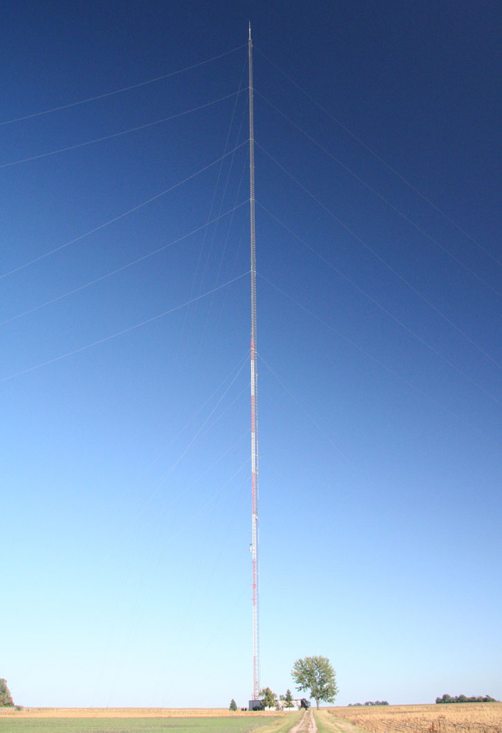
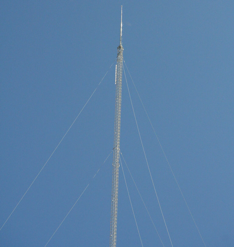
Blanchard, KVLY-TV mast
Coordinates: 47°20'32" N, 97°17'21" W
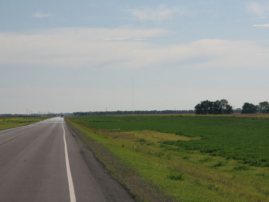
The KVLY-TV mast is the tallest broadcasting tower in the world, the tallest structure in the United States and third-tallest man-made structure in the world (after Burj Dubai and Tokyo Skytree). Completed in 1963, it is used by Fargo station KVLY-TV (Ch. 11).
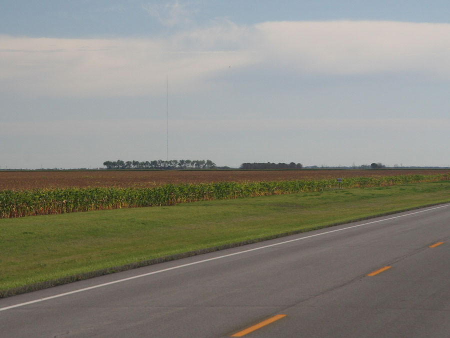
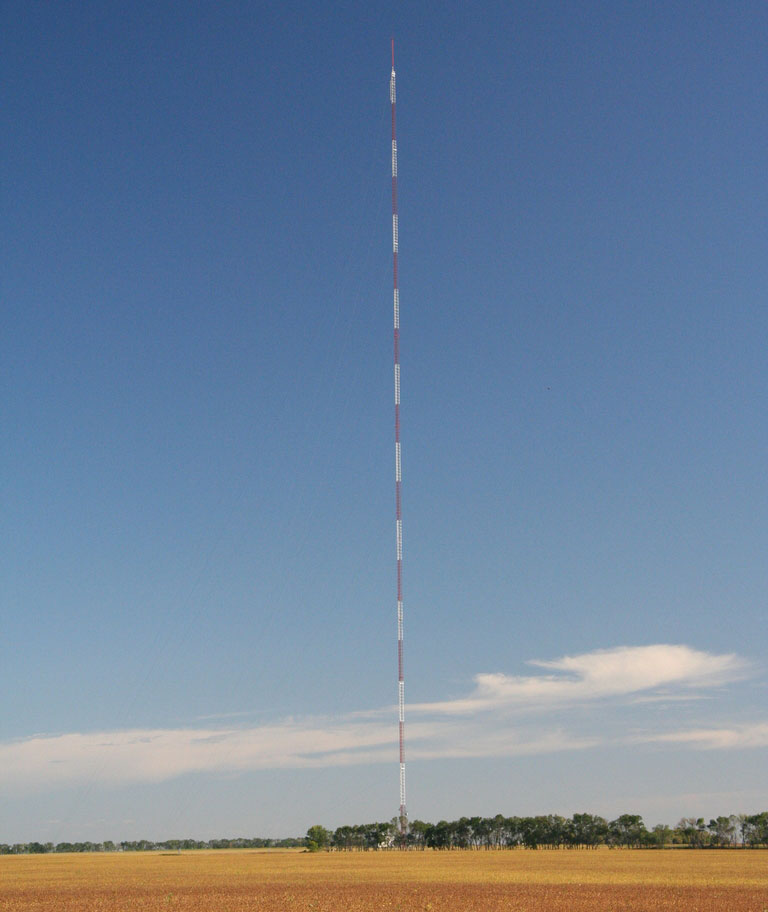
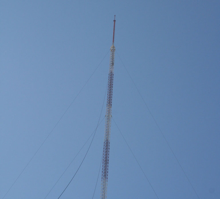

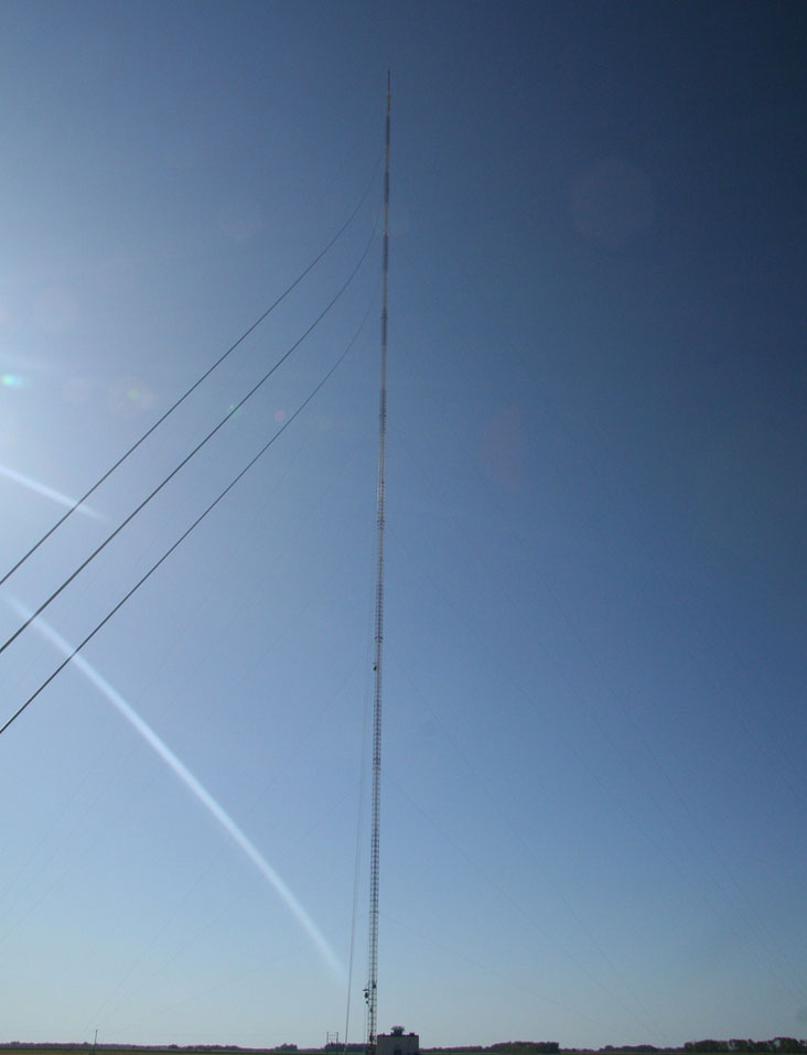
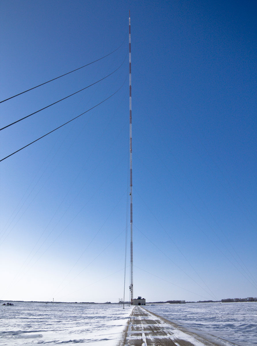
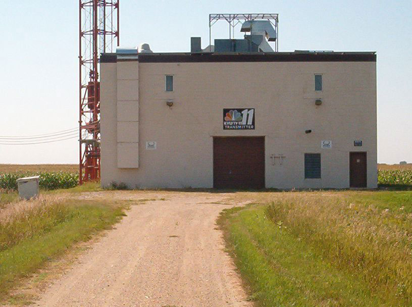

More info: Wikipedia
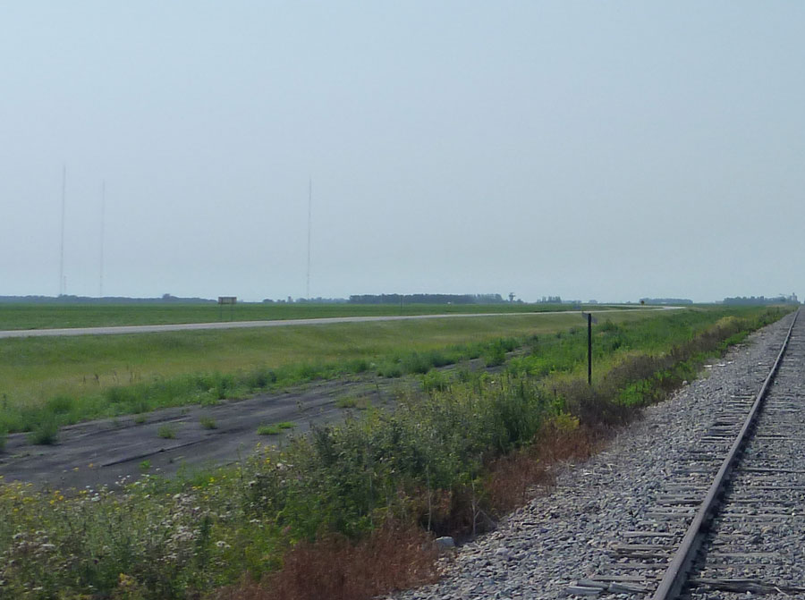
Galesburg, KXJB-TV mast
Coordinates: 47°16'44" N, 97°20'23" W
The KXJB-TV mast is a television transmitting tower near Galesburg, North Dakota. It is shorter by 3.3 ft (1 m) than the KVLY-TV mast which stands a few miles away. The tower was completed in 1966 and is user by Fargo station KXJB (CBS Ch. 4). A 735-foot (224 m) temporary tower stands next to the full-height mast.
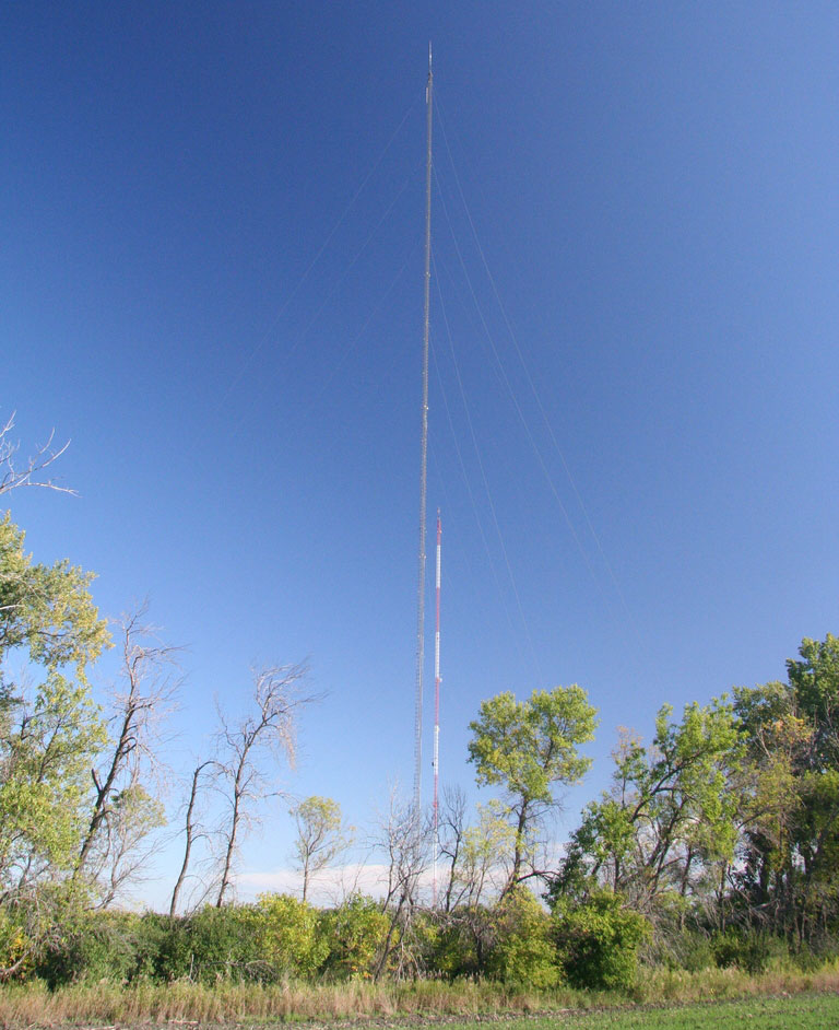
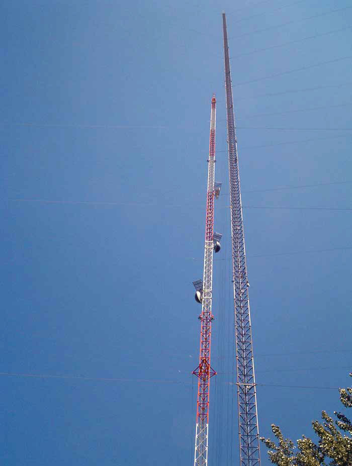
More info: Wikipedia
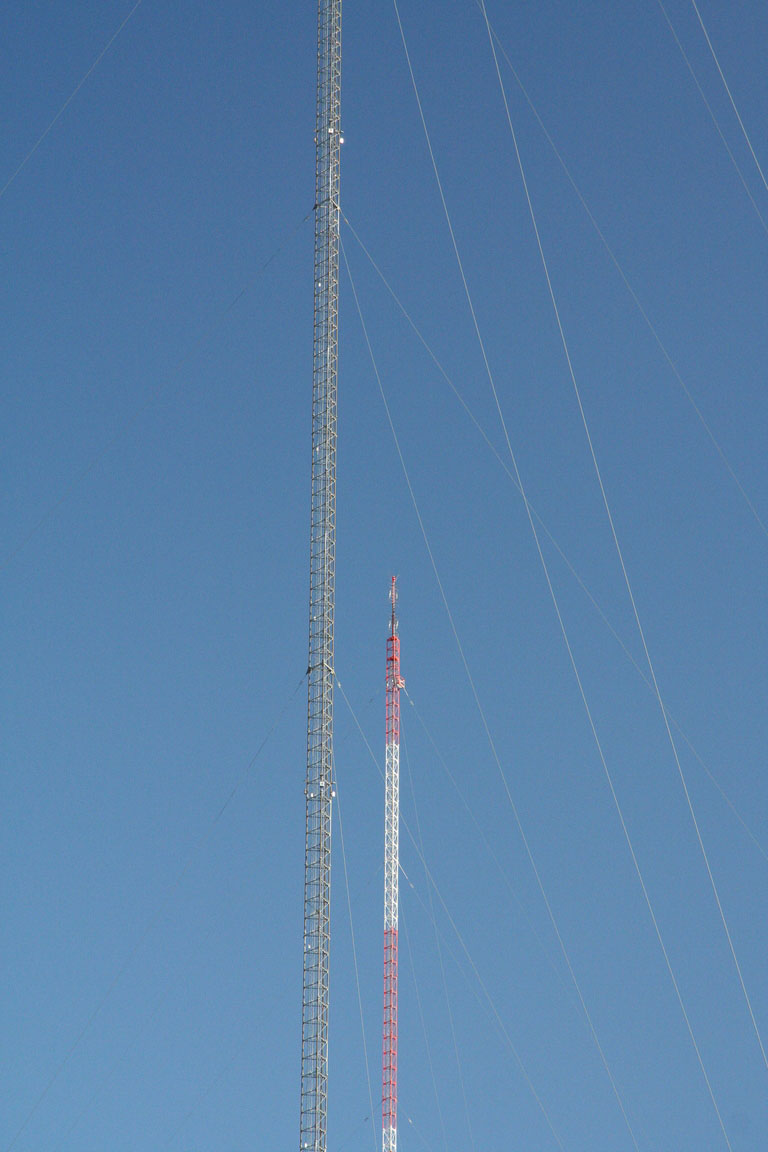
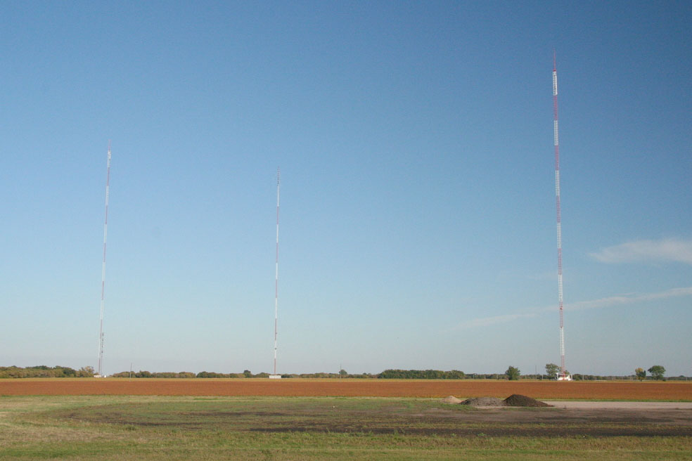
Amenia antenna farm
Coordinates: 47°00'36" N, 97°11'42" W
Amenia tower cluster on Highway 18 includes three towers:
• 1205 ft (367 m) tall WDAY-TV (ABC Ch. 6) tower,
• 1055 ft (322 m) tall KFNW-FM 97.9 MHz tower and
• 1156 ft (352 m) tall Prairie Public Broadcasting - KDSU-FM 91.9 MHz / KFME-TV (PBS Ch. 13) tower.
Useful links
NDBA - North Dakota Broadcasters Association
Your Midwest Media - Radio & TV broadcasting throughout the Upper Midwest
NorthPine.com - Upper Midwest Broadcasting
BostonRadio.org - North Dakota: Land of Tall Towers
Tophour.com audio: Fargo - Moorhead Legal IDs
RadioDiscussions.com - North Dakota Message Board
Fargo, North Dakota at Radio-Locator.com
