
- World Radio Map • North America • United States • New York • Rochester
Radio stations in Rochester, NYClick on the radio station name to listen online |
||
| FM,MHz | Station | Transmitter |
| 88.1 |
 WKEL K-Love WKEL K-Love
|
Newark |
| 88.5 |
 WRUR The Route WRUR The Route
|
Pinnacle Hill |
| 88.9 |
 WCIY Family Life WCIY Family Life
|
South Bristol, Bristol Mountain |
| 89.1 |
 WBSU The Point WBSU The Point
|
Brockport |
| 89.3 |
 WMHN Mars Hill Netw. WMHN Mars Hill Netw.
|
Webster, Holt Rd |
| 89.7 |
 WITR The Pulse of Music WITR The Pulse of Music
|
Henrietta, Rochester Institute of Technology |
| 90.1 |
 WGMC Jazz 90.1 WGMC Jazz 90.1
|
Athena High School |
| 90.5 |
 WBER WBER
|
Victor, Baker Hill |
| 90.9 |
 WIRQ West Irondequoit Radio WIRQ West Irondequoit Radio
|
West Irondequoit |
| 91.5 |
 WXXО WXXI-Classical WXXО WXXI-Classical
└ HD2  WXXI Public Radio WXXI Public Radio
|
Pinnacle Hill |
| 92.1 |
 W221CL NewsPower W221CL NewsPower
|
Pinnacle Hill |
| 92.5 |
 WBEE Today's Country WBEE Today's Country
└ HD2  WGR Rochester WGR Rochester
|
1427 Five Mile Line Rd, Entercom Communications Tower |
| 92.9 |
 W225AR The Station of the Cross W225AR The Station of the Cross
 EWTN Catholic Radio EWTN Catholic Radio
|
Pinnacle Hill |
| 93.3 |
 WFKL Fickle 93.3 WFKL Fickle 93.3
|
1427 Five Mile Line Rd, Entercom Communications Tower |
| 94.1 |
 WZNE The Zone WZNE The Zone
|
Pinnacle Hill |
| 94.7 |
W234AZ Family Life
|
Pinnacle Hill |
| 95.1 |
 WAIO Rock 95.1 WAIO Rock 95.1
└ HD2  WHAM NewsRadio WHAM NewsRadio
|
Victor, Baker Hill |
| 95.7 |
W239BF WGR Rochester
|
281 Colfax St, American Tower |
| 96.1 |
W241DG WHAM NewsRadio
|
Pinnacle Hill |
| 96.5 |
 WCMF Classic Rock WCMF Classic Rock
|
Pinnacle Hill |
| 97.1 |
 WEPL Poder 97.1 WEPL Poder 97.1
|
Clifford Ave and Roth St |
| 97.5 |
 W248BH La Mega W248BH La Mega
|
Xerox Tower |
| 97.9 |
 WPXY 98PXY WPXY 98PXY
└ HD2  Channel Q Channel Q
|
Pinnacle Hill |
| 98.5 |
 WARI Radio Aleluya WARI Radio Aleluya
|
550 E Ave, The Strathallan |
| 98.9 |
 WBZA The Buzz WBZA The Buzz
└ HD2 Family Life
|
281 Colfax St, American Tower |
| 99.3 |
W257ER The Station of the Cross
EWTN Catholic Radio
|
Greece, Woodchuck Hill |
| 99.7 |
 WZXV The Word WZXV The Word
|
Victor, Baker Hill |
| 100.1 |
 W261DR The Lake W261DR The Lake
|
Victor |
| 100.5 |
 WDVI Country 100.5 WDVI Country 100.5
|
Victor, Baker Hill |
| 101.3 |
 WRMM Warm 101.3 WRMM Warm 101.3
|
281 Colfax St, American Tower |
| 101.9 |
W270BX Mars Hill Netw.
|
281 Colfax St, American Tower |
| 102.1 |
 WJCA SonLife Radio WJCA SonLife Radio
|
Albion |
| 102.3 |
 WVOR Sunny 102.3 WVOR Sunny 102.3
└ HD2  Cool Oldies Cool Oldies
└ HD3  The Breeze The Breeze
|
Canandaigua |
| 102.7 |
 WLGZ Legends 102.7 WLGZ Legends 102.7
└ HD2  The Beat The Beat
|
281 Colfax St, American Tower |
| 103.5 |
 WUUF Big Dog Country WUUF Big Dog Country
|
Sodus |
| 103.9 |
 WDKX WDKX
|
Xerox Tower |
| 104.3 |
 WAYO WAYO
|
1237 E Main St |
| 104.9 |
WKDL K-Love
|
Spencerport |
| 105.5 |
W288CS The Beat
|
Xerox Tower |
| 105.9 |
WXXI Public Radio
|
Pinnacle Hill |
| 106.3 |
 WRFZ Rochester Free Radio WRFZ Rochester Free Radio
|
919 S Clinton Ave |
| 106.7 |
 WKGS Kiss 106.7 WKGS Kiss 106.7
|
Pinnacle Hill |
| 107.1 |
 W296EF Truth 990 W296EF Truth 990
|
281 Colfax St, American Tower |
| 107.3 |
 WNBL Big 107.3 WNBL Big 107.3
|
South Bristol, Bristol Mountain |
| 107.5 |
W298CH WXXI Public Radio
|
Webster, Irondequoit Dr |
| 107.7 |
 WGR SportsRadio WGR SportsRadio
└ HD2  Star 102.5 Star 102.5
|
Wethersfield |
| WX,MHz | Station | Transmitter |
| 162.400 |
 KHA53 NOAA Weather Radio KHA53 NOAA Weather Radio
|
Victor, Baker Hill |
| 162.525 |
WNG539 NOAA Weather Radio
|
Spencerport |
| AM,kHz | Station | Transmitter |
| 550 |
WGR SportsRadio
|
Buffalo, NY, Hamburg, Big Tree Rd |
| 570 |
 WSYR NewsRadio WSYR NewsRadio
|
Syracuse, NY, Nedrow |
| 590 |
 CJCL Sportsnet The Fan CJCL Sportsnet The Fan
|
Canada, Toronto, ON, Grimsby, Sobie Rd |
| 620 |
 WHEN Power 620 WHEN Power 620
|
Syracuse, NY, Liverpool |
| 640 |
 CFIQ 640 Toronto CFIQ 640 Toronto
|
Canada, Toronto, ON, Lincoln |
| 680 |
 CFTR NewsRadio Toronto CFTR NewsRadio Toronto
|
Canada, Toronto, ON, Grimsby, Winston Rd |
| 740 |
 CFZM Zoomer Radio CFZM Zoomer Radio
|
Canada, Toronto, ON, Mississauga, Eighth Line |
| 800 |
 CJBQ CJBQ
|
Canada, Belleville, ON, Prince Edward |
| 820 |
 CHAM Big AM 820 CHAM Big AM 820
|
Canada, Hamilton, ON, Binbrook |
| 860 |
 CJBC ICI Première CJBC ICI Première
|
Canada, Toronto, ON, Mississauga, Eighth Line |
| 910 |
 WPYT547 Hwy Advisory Radio WPYT547 Hwy Advisory Radio
|
I-390 and I-490 |
| 930 |
 WBEN News Talk WBEN News Talk
|
Buffalo, NY, Grand Island |
| 950 |
WROC WGR Rochester
|
Brighton, I-390 and I-590 Interchange |
| 990 |
WDCX Truth 990
|
Clarkson |
| 1010 |
 CFRB Newstalk 1010 CFRB Newstalk 1010
|
Canada, Toronto, ON, Mississauga, Royal Windsor Dr |
| 1040 |
WYSL NewsPower
|
Avon |
| 1140 |
 WCJW CJ Country WCJW CJ Country
|
Warsaw |
| 1180 |
WHAM NewsRadio
|
Brook Rd |
| 1280 |
 WHTK Fox Sports 1280 WHTK Fox Sports 1280
|
Brighton, S Winton Rd |
| 1310 |
 WOKR Classic Hits WOKR Classic Hits
|
Canandaigua |
| 1370 |
WXXI Public Radio
|
Brighton, French Rd |
| 1420 |
 WACK Hometown Radio WACK Hometown Radio
|
Newark |
| 1460 |
WHIC The Station of the Cross
EWTN Catholic Radio
|
W Henrietta Rd |
| 1490 |
 WBTA Easy FM WBTA Easy FM
|
Batavia |
| 1520 |
 WWKB The Bet WWKB The Bet
|
Buffalo, NY, Hamburg, Big Tree Rd |
| 1550 |
WCGR The Lake
|
Canandaigua |
| 1600 |
WRSB La Mega
|
Brockport |
| 1610 |
 WPZN807 Hwy Advisory Radio WPZN807 Hwy Advisory Radio
|
New York State Thruway (I-90) |
| 1610 |
WPWC517 Hwy Advisory Radio
|
NY Rte 104 and I-490 |
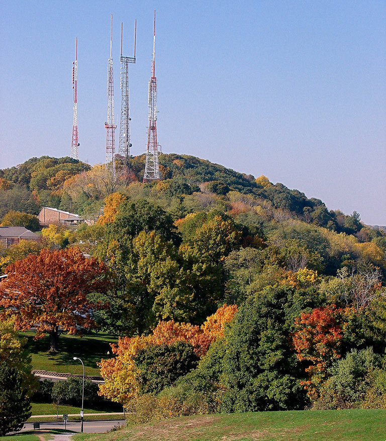
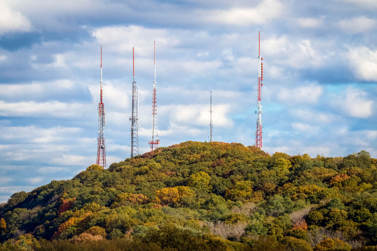
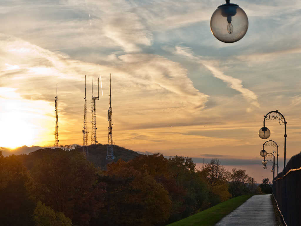
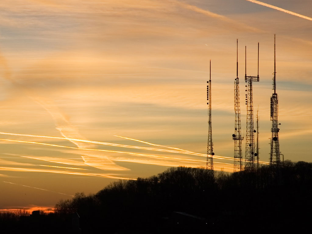
Pinnacle Hill
Coordinates: 43°08'08" N, 73°35'01" W
Transmitter towers for NBC, ABC, CBS, FOX affiliates and PBS, as well as many radio stations serving Rochester, NY and Monroe County are located on Pinnacle Hill on the border between Rochester and Brighton. Pinnacle Hill is the highest point in Rochester – 749 feet above sea level.


Bristol Mountain
Coordinates: 42°44'47" N, 77°25'31" W
Radio Broadcasting Tower on the Bristol Mountain summit is a historic broadcast tower that was used by Rural Radio Network from 1948. Today the site is used by radio stations WNBL 107.3 FM (licensed to South Bristol) and WCIY 88.9 FM (licensed to Canandaigua).

More info: Wikipedia
Useful links
NYSBA - New York State Broadcasters Association
NYRMB.com - New York Radio Message Board
Fybush.com Tower site of the week: "Rochester Radio City" (WHAM-TV/WROC-TV)
Tophour.com audio: Rochester Legal IDs
RadioDiscussions.com - Buffalo / Niagara Falls / Rochester Message Board
RadioDiscussions.com - New York Message Board
Rochester, New York at Radio-Locator.com
