
- World Radio Map • North America • United States • Tennessee • Knoxville
Radio stations in Knoxville, TNClick on the radio station name to listen online |
||
| FM,MHz | Station | Transmitter |
| 88.1 |
 WUTC Public Radio WUTC Public Radio
└ HD2  WUTC-2 WUTC-2
|
Chattanooga, TN, Signal Mountain |
| 88.3 |
 WYLV K-Love WYLV K-Love
|
Sharp’s Ridge |
| 88.7 |
 WWQK The Life FM WWQK The Life FM
|
Wartburg, Pilot Mountain |
| 89.1 |
 WOFM Air 1 WOFM Air 1
|
Sharp’s Ridge |
| 89.7 |
 WYBK Bible Broadcasting Netw. WYBK Bible Broadcasting Netw.
|
Chattanooga, TN, Signal Mountain |
| 89.9 |
 WDVX East Tennessee's Own WDVX East Tennessee's Own
|
Briceville, Cross Mountain |
| 90.3 |
 WUTK The Rock WUTK The Rock
|
University of Tennessee |
| 90.5 |
 WSMC Classical WSMC Classical
|
Chattanooga, TN, Soddy-Daisy, Montlake |
| 90.7 |
 WGSN New Life Radio WGSN New Life Radio
|
Newport |
| 91.1 |
 WKCS Falcon Radio WKCS Falcon Radio
|
Fulton High School |
| 91.9 |
 WUOT Public Radio WUOT Public Radio
└ HD2  WUOT-2 WUOT-2
|
Sharp’s Ridge |
| 92.3 |
 W222BA Talk Radio W222BA Talk Radio
|
Sharp’s Ridge |
| 92.7 |
 WIJV Victory 92.7/94.7 WIJV Victory 92.7/94.7
|
Kingston |
| 93.1 |
 WNOX Classic Rock WNOX Classic Rock
|
6305 Vance Ln |
| 93.5 |
 WKZX La Líder WKZX La Líder
|
Lenoir City |
| 93.7 |
 W229DO Rock W229DO Rock
|
Lake Forest, 2825 Chapman Hwy |
| 93.9 |
W230BR East Tennessee's Own
|
Seymour, Bay’s Mountain, Mutton Hollow |
| 94.3 |
 WNFZ Jack FM WNFZ Jack FM
|
2833 Sands Rd |
| 94.7 |
W234CU Victory 92.7/94.7
|
Sharp’s Ridge |
| 94.9 |
 WAEZ Electric 94.9 WAEZ Electric 94.9
|
Greeneville, Greystone Mountain |
| 95.3 |
WYFC Bible Broadcasting Netw.
|
Clinton, Ventis Ln |
| 95.7 |
 WDKW The Duke WDKW The Duke
|
Maryville, Louisville |
| 96.3 |
 WJBZ Praise 96.3 WJBZ Praise 96.3
|
Seymour, Bay’s Mountain, Mutton Hollow |
| 96.5 |
 WDOD Hits 96 WDOD Hits 96
|
Chattanooga, TN, Signal Mountain |
| 96.7 |
 WMYL Merle FM WMYL Merle FM
|
Clinton, Ventis Ln |
| 97.1 |
 W246DH Jump 97.1 W246DH Jump 97.1
|
Sharp’s Ridge |
| 97.5 |
 WJXB B97.5 WJXB B97.5
|
Sharp’s Ridge |
| 97.9 |
 WLHR-LP WLHR-LP
|
Maryville, East Maryville Baptist Church |
| 98.1 |
 W251BR The Light FM W251BR The Light FM
|
Sharp’s Ridge |
| 98.3 |
 WMTY Oldies WMTY Oldies
|
Sweetwater |
| 98.7 |
 WOKI News Talk WOKI News Talk
|
Clinton, Pine Ridge |
| 99.1 |
 WNML Sports Animal WNML Sports Animal
 Westwood One Sports Westwood One Sports
|
Maryville, US Hwy 411 S |
| 99.3 |  WNRX The Lake WNRX The Lake |
Jefferson City |
| 99.7 |
 W259AV Jammin' 99.7 W259AV Jammin' 99.7
|
Sharp’s Ridge |
| 99.9 |
 WKSF Kiss Country WKSF Kiss Country
└ HD2  The Brew The Brew
|
Asheville, NC, Mount Pisgah |
| 100.3 |
 WCYQ The Wolf WCYQ The Wolf
|
Briceville, Cross Mountain |
| 100.7 |
 W264CJ Gospel Radio W264CJ Gospel Radio
|
3505 Peachwood Rd |
| 101.1 |
 WIAM The Way WIAM The Way
|
2906 Washington Pike |
| 101.7 |
 WJSQ WJSQ
|
Athens |
| 102.1 |
 WWST Star 102.1 WWST Star 102.1
|
Bluff Mountain - Green Top |
| 102.5 |
 W273DX Joy 620 W273DX Joy 620
|
Sharp’s Ridge |
| 102.9 |
W275AD East Tennessee's Own
|
Sharp’s Ridge |
| 103.1 |
 WBDX J103 WBDX J103
|
Athens |
| 103.5 |
 WIMZ Classic Rock WIMZ Classic Rock
|
Zachary Ridge |
| 104.1 |
 WMJA Magic 104.1 WMJA Magic 104.1
|
Loudon |
| 104.5 |
 WKHT Hot 104.5 WKHT Hot 104.5
|
Sharp’s Ridge |
| 104.9 |
 WKVL 104.9-KVL WKVL 104.9-KVL
|
Look Rock |
| 105.3 |
 WFIV West 105.3 WFIV West 105.3
|
Lenoir City |
| 105.5 |
 WSEV Mix 105.5 WSEV Mix 105.5
|
Gatlinburg, Ski View Drive |
| 105.7 |
 WIHG The Hog WIHG The Hog
└ HD2  The Vibe The Vibe
└ HD3  The Ranch The Ranch
└ HD4  Spirit 101.9 Spirit 101.9
|
Crossville, Renegade Mountain |
| 105.7 |
 W289CU Fanrun Radio W289CU Fanrun Radio
|
1017 Cox St |
| 105.9 |
 W290DJ Greg FM W290DJ Greg FM
|
Maryville |
| 106.1 |
 WATO Atomic 106 WATO Atomic 106
|
Oliver Springs, Upper Wind Rock Rd |
| 106.3 |
 WPFT Talk 106.3 WPFT Talk 106.3
|
Gatlinburg, Ski View Drive |
| 106.7 |
WFGW The Light FM
|
5126 Fort Sumter Rd |
| 106.9 |
WMIT The Light FM
|
Asheville, NC, Clingmans Peak |
| 107.3 |
W297AX Victory 92.7
|
Bluff Mountain - Green Top |
| 107.7 |
 WIVK WIVK
|
Bluff Mountain - Green Top |
| WX,MHz | Station | Transmitter |
| 162.450 |
 WNG732 NOAA Weather Radio WNG732 NOAA Weather Radio
|
Briceville, Cross Mountain |
| 162.475 |
WXK46 NOAA Weather Radio
|
Sharp’s Ridge |
| 162.550 |
WXK47 NOAA Weather Radio
|
Bristol, Holston Mountain |
| AM,kHz | Station | Transmitter |
| 540 |
 WRGC The River WRGC The River
|
Sylva, NC |
| 560 |
 WMIK Family Christian Radio WMIK Family Christian Radio
|
Middlesboro, KY |
| 580 |
WXRH The Ranch
|
Rockwood |
| 620 |
WRJZ Joy 620
|
Holston Hills |
| 650 |
 WSM The Legend WSM The Legend
|
Nashville, TN, Brentwood |
| 720 |
 WGCR Gospel Carolina Radio WGCR Gospel Carolina Radio
|
Pisgah Forest, NC |
| 730 |
 WLIL Country WLIL Country
|
Lenoir City |
| 750 |
 WSB News Talk WSB News Talk
|
Atlanta, GA, Northlake Tower Festival Shopping Plaza |
| 760 |
WETR Talk Radio
|
Holston Hills |
| 840 |
 WHAS NewsRadio WHAS NewsRadio
|
Louisville, KY, 1502 Flat Rock Rd |
| 850 |
WVLZ Rock
|
Maryville |
| 900 |
WKXV Gospel Radio
|
3505 Peachwood Rd |
| 930 |
 WSEV ESPN Radio WSEV ESPN Radio
|
Sevierville |
| 940 |
 WECO Solid Gospel WECO Solid Gospel
|
Wartburg |
| 960 |
 WQLA 95.9 Rocks WQLA 95.9 Rocks
|
LaFollette |
| 990 |
WNML Sports Animal
Westwood One Sports
|
Anderson Rd |
| 1040 |
WJBE Jammin' 99.7
|
Powell, Broadacres |
| 1070 |
 WFLI The Big One WFLI The Big One
|
Chattanooga, TN, 621 O'Grady Dr |
| 1110 |
 WBT WBT
|
Charlotte, NC, 9201 Nations Ford Rd |
| 1120 |
WTLT Jump 97.1
|
Seymour |
| 1180 |
 WKCE Mid-century Radio WKCE Mid-century Radio
|
Strawberry Plains Pike |
| 1240 |
 WIFA Faith 1240 WIFA Faith 1240
|
Painter Ave SW |
| 1340 |
WKGN Fanrun Radio
|
1099 Cox St |
| 1360 |
 WBLC 3ABN Radio WBLC 3ABN Radio
|
Lenoir City |
| 1380 |
 WYSH Classic Country WYSH Classic Country
|
Clinton |
| 1400 |
WGAP Greg FM
|
Maryville |
| 1470 |
 WBCR Truth Radio WBCR Truth Radio
|
Maryville, 1217 Tuckaleechee Trl |
| 1490 |
 WITA The Gospel WITA The Gospel
 The Overcomer Ministry The Overcomer Ministry
|
Richmond Ave |
| 1510 |
 WLAC TalkRadio WLAC TalkRadio
|
Nashville, TN, Dickerson Pike and W Old Hickory Blvd |
| 1580 |  WNPZ Power 1580 WNPZ Power 1580 |
South Woodlawn |
| 1620 |
 WQBJ215 Hwy Advisory Radio WQBJ215 Hwy Advisory Radio
|
I-40, I-640, I-75, I-140 |
| Online | Station | |
 Cross Roads Radio Network Cross Roads Radio Network
|
||
Sharp's Ridge
Coordinates: 36°00'13" N, 83°56'34" W
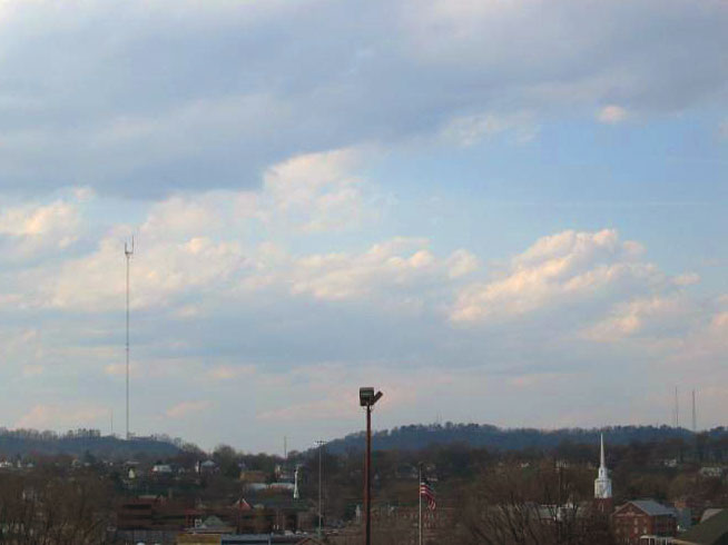
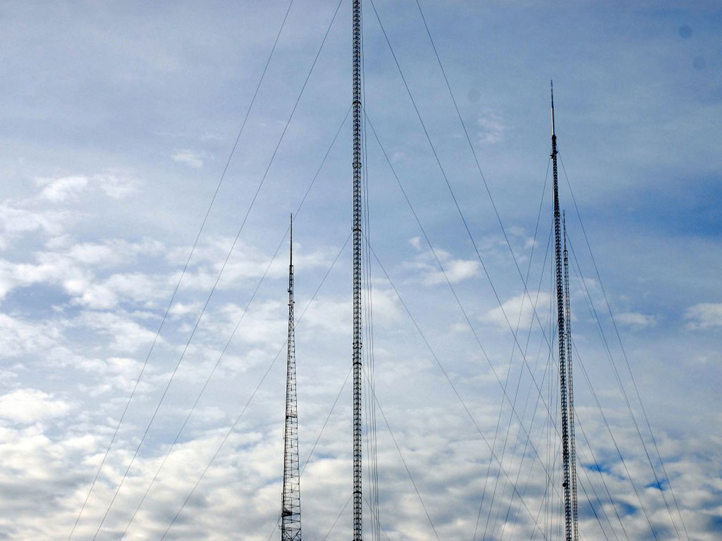
Sharp's Ridge is a steep ridge in Knoxville, Tennessee, north of the city's downtown. The ridge is home to transmitter towers of many TV and radio stations in Knoxville, includng:
• 1534 ft (467.6 m) tall American Tower / WVLT-TV (CBS Ch. 8) / WKOP-TV (PBS Ch. 15) tower, south of the I-75/I-275/I-640 Interchange,
• 1456 ft (443.8 m) tall American Tower / WATE-TV (ABC Ch. 6) / WTNZ-TV (Fox Ch. 43) tower at 363 Sharp's Ridge Memorial Park Drive,
• 1504 ft (458.4 m) tall WBIR-TV (NBC Ch. 10) tower at 601 Sharp's Ridge Memorial Park Drive and
• 1088 ft (331.6 m) tall Midwest Communications tower at 1100 Sharp's Ridge Memorial Park Drive.


More info: Wikipedia
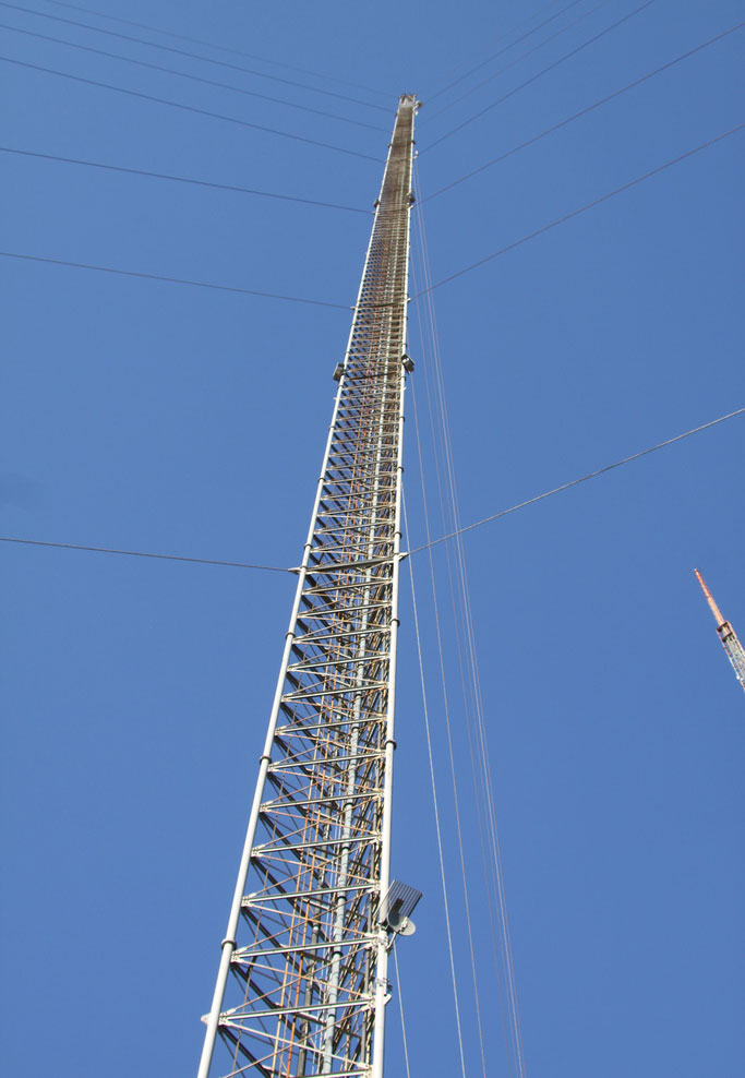
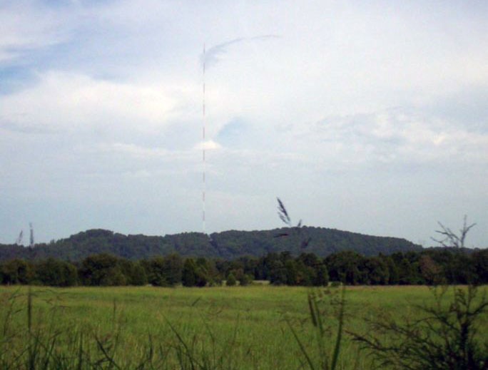
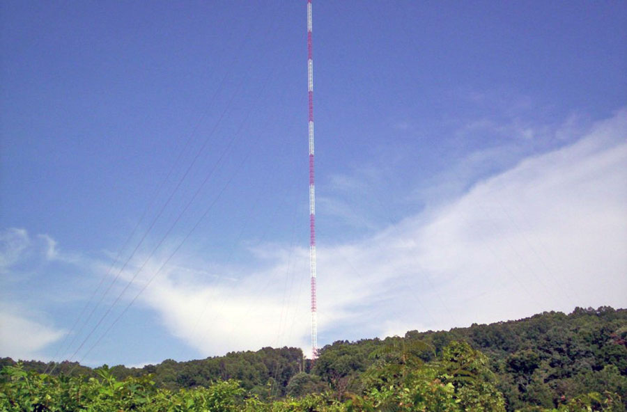
Zachary Ridge, WIMZ-FM Tower
Coordinates: 36°08'06" N, 83°43'28" W
The WIMZ FM-Tower is a guy-wired aerial mast for the transmission of FM and TV programs on Zachary Ridge near House Mountain, northeast of Knoxville, Tennessee. The tower was completed in September 1963, at the time was the tallest structure in the world and still is the tallest man-made structure in the state of Tennessee. Originally, the tower was used for television broadcasts by WBIR-TV (Ch. 10).
Useful links
TAB - Tennessee Association of Broadcasters
Tennessee Radio and TV Station Photos from the John in Montana Collection
Tophour.com audio: Knoxville Legal IDs
RadioDiscussions.com - Tennessee Message Board
Knoxville, Tennessee at Radio-Locator.com
