
- World Radio Map • Oceania • New Zealand • Christchurch, Canterbury / Ōtautahi, Waitaha
Radio stations in ChristchurchTeihana reo irirangi o ŌtautahiClick on the radio station name to listen online |
||
| FM,MHz | Station / Pou reo irirangi | Transmitter / Pou pāho |
| 87.6 |
 Life FM Life FM
|
Christchurch |
| 87.8 |
 Power Hit Radio Power Hit Radio
|
Saint Albans |
| 87.9 |
 Costwood FM Costwood FM
|
Bishopdale, Cotswold School |
| 88.1 |
 3ABN Christian Radio 3ABN Christian Radio
|
Christchurch |
| 88.3 |
 Beep FM Beep FM
|
New Brighton |
| 88.9 |
 The Edge The Edge
|
Sugarloaf |
| 89.3 |
 Radio Hauraki Radio Hauraki
|
Sumner |
| 89.7 |
 Radio New Zealand Concert Radio New Zealand Concert
|
Sugarloaf |
| 90.1 |
 Coast Coast
|
Sumner |
| 90.5 |
 Tahu FM Tahu FM
|
Sugarloaf |
| 90.9 |
 ZM ZM
|
Sumner |
| 91.1 |
 Akaroa Radio Akaroa Radio
|
Akaroa Hilltop |
| 91.3 |
ZM
|
Sugarloaf |
| 91.7 |
 iHeart Country iHeart Country
|
Sumner |
| 92.1 |
 More FM More FM
|
Sugarloaf |
| 92.5 |
 Hokonui Hokonui
|
Ashburton |
| 92.9 |
 The Sound The Sound
|
Sugarloaf |
| 93.3 |
 Anthemz FM Anthemz FM
|
Sumner |
| 93.7 |
 The Rock The Rock
|
Sugarloaf |
| 94.5 |
 The Breeze The Breeze
|
Sugarloaf |
| 94.9 |
More FM
|
South New Brighton |
| 95.3 |
 George FM George FM
|
Sugarloaf |
| 96.1 |
 Summit 96.1 Summit 96.1
|
Sugarloaf |
| 96.5 |
 The Hits The Hits
|
Sumner |
| 96.9 |
 Plains FM Plains FM
 BBC World Service BBC World Service
|
Sugarloaf |
| 97.7 |
The Hits
|
Sugarloaf |
| 98.5 |
 RDU RDU
|
Huntsbury Hill + Ilam + Marley's Hill + Sumner |
| 99.3 |
 Magic Magic
|
Sugarloaf |
| 99.7 |
Radio New Zealand Concert
|
Sumner |
| 100.1 |
 Newstalk ZB Newstalk ZB
|
Sugarloaf |
| 100.9 |
 Pulzar FM Pulzar FM
|
Huntsbury Hill |
| 101.7 |
 Radio New Zealand National Radio New Zealand National
|
Sugarloaf |
| 104.1 |
 Radio 531pi Radio 531pi
|
Sugarloaf |
| 104.9 |
 Compass FM Compass FM
|
Rangiora, Mount Grey |
| 105.7 |
Coast
|
Sugarloaf |
| 106.5 |
Radio Hauraki
|
Sugarloaf |
| 106.8 |
 Mai FM Mai FM
|
Christchurch |
| 107.0 |
 Breens Beats Breens Beats
|
Bishopdale, Breens Intermediate School |
| 107.1 |
 Beachbreak FM Beachbreak FM
|
South New Brighton School |
| 107.1 |
 Lift FM Lift FM
|
Spreydon |
| 107.1 |
 WaiTalk FM WaiTalk FM
|
Burwood, Waitakiri School |
| 107.2 |
 Oaklands FM Oaklands FM
|
Halswell, Oaklands School |
| 107.3 |  Ola Taumafai FM Ola Taumafai FM |
Aranui |
| 107.3 |
 Surfer Sounds Surfer Sounds
|
Sumner School |
| 107.3 |
 XS80s XS80s
|
Cashmere |
| 107.4 |
 Dave FM Dave FM
|
Burwood |
| 107.5 |
 Radio Addington Radio Addington
|
Addington |
| 107.5 |
 Radio Redwood Radio Redwood
|
Redwood |
| 107.7 |
 Just FM Just FM
|
Kaiapoi |
| 107.7 |
 Oak FM Oak FM
|
St. Albans School |
| 107.7 |
 ChizzySoundz ChizzySoundz
|
Chisnallwood Intermediate School |
| AM,kHz | Station / Pou reo irirangi | Transmitter / Pou pāho |
| 540 |
 Rhema Rhema
|
Gebbies Pass |
| 567 |
Radio New Zealand National
|
Wellington, Titahi Bay |
| 612 |
 Star Star
|
Marshland |
| 657 |
Star
 New Zealand Parliament New Zealand Parliament
|
Wellington, Titahi Bay |
| 675 |
Radio New Zealand National
|
Gebbies Pass |
| 738 |
The Breeze
|
Marshland |
| 963 |
Star
New Zealand Parliament
|
Gebbies Pass |
| 1017 |
Newstalk ZB
|
Philpotts Rd |
| 1098 |
Newstalk ZB
|
Ouruhia |
| 1260 |
 Sport Nation Sport Nation
|
Marshland |
| 1413 |
 Radio Ferrymead Radio Ferrymead
|
Ferrymead |
| 1503 |
 Gold Sport Gold Sport
|
Ouruhia |
| 1593 |
Coast
|
Marshland |
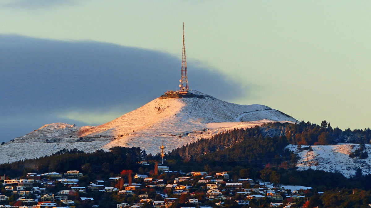
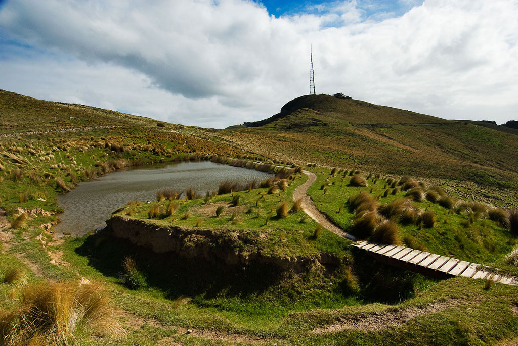
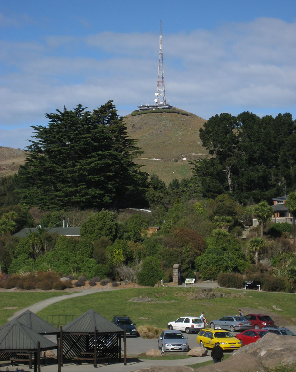
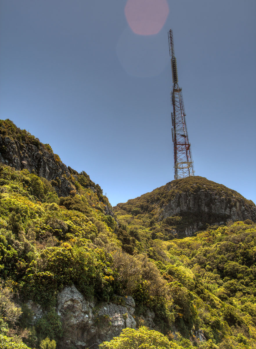
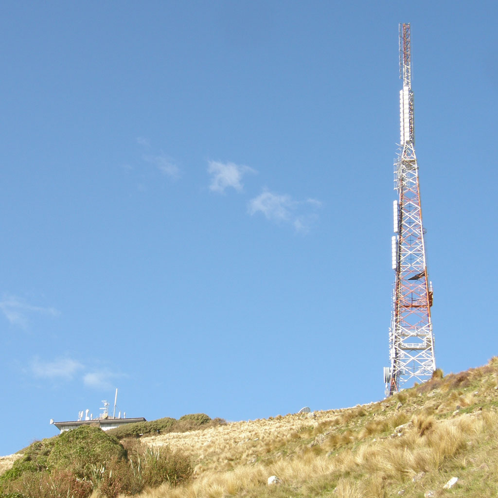
Sugarloaf
Coordinates: 27°27'51" S, 152°56'51" E
The Sugarloaf in Christchurch's Port Hills is a landmark to the south of the city. The Sugarloaf communications tower is an iconic transmission mast located on top of the hill. The tower is situated at an elevation of 493.78 m on the top of the Port Hills, near Dyers Pass. With a height of 121 m, the lattice steel structured tower is founded on a 5 metre deep concrete pad underlain by basalt volcanic rock. It is situated approximately 50 m behind the main transmission building, which combined with the tower is visible from most parts of Christchurch city.
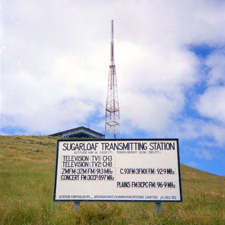
More info: Wikipedia
Useful links
RSM - Radio Spectrum Management
RBA - Radio Broadcasters Association Inc.
CAMA - Community Access Media Alliance
Radio Today - Australia and New Zealand's leading radio industry website
Radio Heritage Foundation - The New Zealand Radio Guide
FrequencyFinder.co.nz
RadioFM.co.nz - FM Radio stations in New Zealand
NZ Radio Guide - New Zealand Radio Stations Online
New Zealand Vintage Radio Society
Maritime Radio - dedicated to the history of New Zealand radio communication stations
Irirangi.net - Māori radio broadcasting in Aotearoa
LPFM.org.nz - Society of New Zealand Low Power FM Broadcasters
New Zealand Low Power FM Radio Station Network
NZART - New Zealand Association of Radio Transmitters
RadioDX.com - New Zealand Radio DX League
TRB - The Radio Bureau
